The 2005 CAP (closed on June 16, 2005) announcement is available here. $1,300,000 was granted under this year's program.
- 2005 Project Factsheet Version
- Project List - includes status information
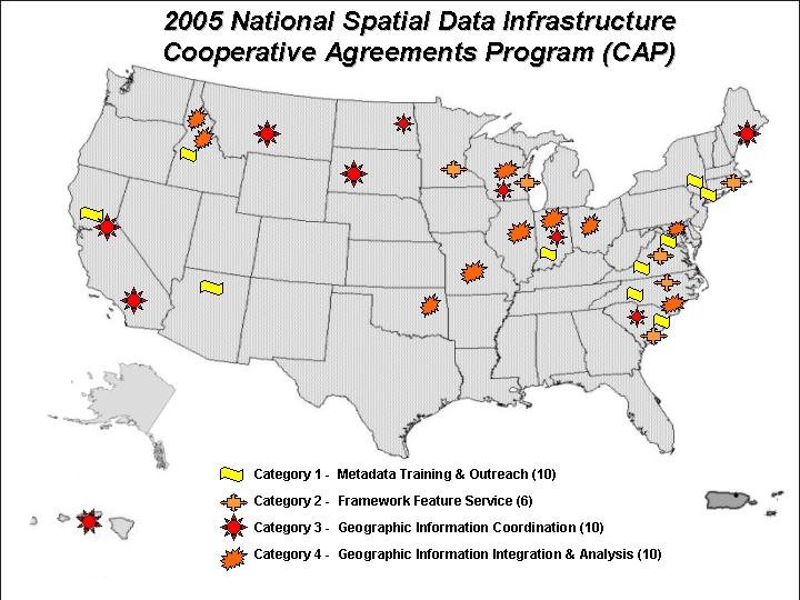
- Project Maps: Interactive
 or JPEG Format
Category 1: Metadata Trainer and Outreach Assistance Projects - Creating data about geospatial data (metadata) is an important first step in implementing the NSDI. These project organizations will provide training and assistance to other organizations in the implementation of metadata, clearinghouse and web mapping services. Up to $30,000 per project, 10 awards.
| Virginia Polytechnic Institute Conservation Management Institute Blacksburg, VA Andrew Rosenberger ------------------------ |
Center for International Earth Science Information Columbia University Palisades, NY Mark Becker Robert Chen ------------------------ |
| U.S. Geological Survey National Biological Information Infrastructure Seattle, WA Vivian Hutchison ------------------------ |
University of Idaho Library Moscow, ID Bruce Godfrey ------------------------ |
| NOAA Coastal Service Center Charleston, SC David Stein ------------------------ |
Sonoma Ecology Center Eldridge, CA Deanne DiPietro ------------------------ |
| Merriam-Powell Center for Environmental Research Flagstaff, AZ Neil Cobb ------------------------ |
Indiana University Northwest Center for Data and Analysis Bloomington, IN Timothy Sutherland ------------------------ |
| Westchester County, NY Department of Information Technology GIS White Plains, NY Sam Wear Ana Hiraldo |
|
Category 2: Establishing Framework Data Service Projects - These projects will implement methodologies for serving and using Framework data over the Web using the Open Geospatial Consortium Web Feature Service specification. Projects will collaborate between a data provider and a software provider. Up to $50,000 per project, 6 projects.
| University of Wisconsin-Milwaukee Center for Advanced Spatial Information Research Milwaukee, WI Dr. Zhong-Ren Peng ------------------------ |
University of Rhode Island Department of Natural Resources Science Environmental Data Center Kingston, RI Peter August ------------------------ |
| Land Management Information Center Minnesota Department of Administration St. Paul, MN Christopher Cialek ------------------------ |
NOAA Coastal Services Center Charleston, SC Daniel Martin Greg Glover ------------------------ |
| North Carolina Department of Environment and Natural Resources Raleigh, NC Julia Harrell |
George Mason University Center for Earth Observing and Space Research Fairfax, VA Chaowei Phil Yang |
Category 3: Geographic Information Coordination - These projects led by consortia of public and non-profit organizations will develop new or strengthen existing multi-organizational collaboration that supports the development and maintenance of a shared digital geographic resource and foster establishment of cross-organizational coordinating councils that develop and advance the NSDI within a specific geographic area. Up to $20,000 per award, 10 projects.
| Indiana Geographic Information Council Indianapolis, IN Jill Saligoe-Simmel ------------------------ |
Wisconsin Land Information Association Almond, WI Ann Barrett ------------------------ |
| Richland County, ND Wahpeton, ND Doug Bartels ------------------------ |
South Carolina Division of the State Chief Information Officer Columbia, SC George Crouch ------------------------ |
| Center for Cultural and Technical Interchange Between East and West, Pacific Disaster Center Honolulu, HI Chris Chiesa ------------------------ |
California Invasive Plant Council Berkeley, CA Doug Johnson ------------------------ |
| Island Institute Rockland, ME Shey Veditz ------------------------ |
California Geographic Information Association Sacramento, CA John Ellison George White ------------------------ |
| Black Hills Digital Mapping Association, Inc Rapid City, SD Jenifer Sorensen |
Montana Department of Administration Information Technology Services Division Helena, MT Stewart Kirkpatrick |
Category 4: Geographic Information Integration - This category funds project organizations and consortia that maintain, update and make available data, in collaborating with the National Geospatial Program Office and The National Map. Funds are provided to help new participants overcome initial impediments to participation and to help existing participants improve their web services and provide them through The National Map. Up to $50,000 per award, 10 projects.
| Coeur d'Alene Tribe Plummer, ID Frank Roberts ------------------------ |
Indiana Geographic Information Council Indianapolis, IN Jill Saligoe-Simmel ------------------------ |
| Towson University Towson, MD Matthew Felton ------------------------ |
University of Oklahoma Norman, OK May Yuan ------------------------ |
| North Carolina Department of Environment and Natural Resources Raliegh, NC Joe Sewash ------------------------ |
Illinois State Geological Survey University of Illinois Champaign, IL Robert Krumm ------------------------ |
| Ohio Office of Information Technology Enterprise Shared Services Columbus, OH Jeff Smith ------------------------ |
University of Idaho Library Moscow, ID Bruce Godfrey ------------------------ |
| University of Missouri Missouri Spatial Data Information Service Columbia, MO Timothy Haithcoat Mark Deuwell |
Wisconsin Department of Natural Resources Division of Water Madison, WI Ann Schachte |