 |
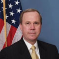
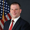
Jennifer Gimbel Ms. Jennifer Gimbel was named Principal Deputy Assistant Secretary for Water and Science in October 2014 and is responsible for overseeing water and science policy for the U.S. Department of the Interior (DOI), specifically through oversight of the U.S. Bureau of Reclamation and the U.S. Geological Survey. In addition to her leadership on water issues, Ms. Gimbel administers the National Land Imaging Program. Ms. Gimbel previously worked at Reclamation on a variety of policy and program issues and served as the Director of the Colorado Water Conservation Board. She has a bachelor of science degree and Juris Doctorate from the University of Wyoming and a master of science from the University of Delaware.
|
 |
Scott Bernard Prior to his 2010 appointment to Office of Management and Budget (OMB), Dr. Scott Bernard was the Deputy Chief Information Officer and Chief Enterprise Architect for the Federal Railroad Administration. He received a doctorate in Public Administration and Policy from Virginia Polytechnic Institute and State University and a master of science degree from Syracuse University.
|
 |
Ivan DeLoatch Mr. Ivan DeLoatch has served as the Executive Director of the FGDC for the past 12 years. Previously, he served as Chief of the Data Acquisition Branch in the U.S. Environmental Protection Agency’s Office of Environmental Information. He earned a bachelor of science degree in biology from Bowie State University.
|
FGDC Executive Committee
 |
David Alexander Mr. Alexander’s career in the geospatial information field spans more than three decades. He assumed responsibility for the U.S. Department of Homeland Security (DHS) Geospatial Management Office in 2012 after having spent 4 years in senior leadership roles with the DHS Office of the Chief Information Officer. Mr. Alexander has led several national initiatives, including the Homeland Security Geospatial Concept of Operations (GeoCONOPS), the DHS Geospatial Information Infrastructure, the Homeland Infrastructure Foundation-Level Data (HIFLD) Working Group, and technical lead for response coordination in the Department of Health and Human Services, the Secretary’s Operations Center. Mr. Alexander holds several advanced degrees encompassing history, geography, and business management.
|
 |
Jeff Bell
Mr. Jeffrey Bell directly supports the National Geospatial-Intelligence Agency Chief Information Officer in fulfilling his functional management responsibilities for geospatial intelligence standards and architecture for the National Systems for Geospatial-Intelligence community. Mr. Bell has been active in geospatial standards development, governance, and implementation for the last 9 years, coordinating and harmonizing military requirements and standards development activities with civil, industry, and international standards organizations. He serves as the Chair of the Geospatial Intelligence Standards Working Group (GWG).
|
 |
Jerry Johnston Dr Jerry Johnson has been with the U.S. Department of the Interior for the past 4 years. Prior to this, he served as the Geographic Information Officer for the U.S. Environmental Protection Agency (EPA) for several years. Before his time with EPA, Dr. Johnston conducted research on complex environmental systems modeling and served as the project manager for numerous geospatial projects in the private sector. He holds a master’s degree and doctorate in environmental science from Indiana University, Bloomington, as well as a bachelor of science degree in environmental science from Michigan State University. Dr. Johnston currently serves as Vice Chair for the National Geospatial Advisory Committee.
|
 |
Stephen Lowe Mr. Stephen Lowe has over 25 years of Federal Government business and technology transformation experience. He has also completed two term appointments supporting the White House Executive Office of the President and served as Senior Solutions Architect for Enterprise Innovation and Strategy with SRA International. Mr. Lowe holds graduate degrees in management of information technology from the University of Virginia and in public administration from Virginia Polytechnic Institute and State University. He also holds a bachelor of arts degree in political science from James Madison University. |
 |
Keith Keller, (Acting) Associate Director for Innovation/Chief Technology Officer |
 |
Harvey Simon Mr. Harvey Simon has been EPA’s Geospatial Information Officer since July 2012 and is responsible for coordinating EPA’s geospatial program. Prior to that, he was Chief of the Information Services Branch in the Office of Information Analysis and Access, which is responsible for the Envirofacts database, a number of national geospatial applications and services, and operational management of the EPA GeoPlatform. Previously, Mr. Simon held the role of Geographic Information System (GIS) Coordinator for Region 2 and Chair of the EPA GIS Workgroup, including its Emergency Response GIS subgroup. Mr. Simon brings 28 years of GIS and risk analysis experience to his current position. He has an undergraduate and a master’s degree from the State University of New York. |
 |
Timothy Trainor Mr. Timothy Trainor is Chief of the Geography Division at the U.S. Census Bureau and is responsible for managing the MAF/TIGER System, a national resource of addresses and geospatial information to support data collection, tabulation, and dissemination for censuses and surveys. As a Rotary Fellow, he holds a post-graduate diploma in cartography from Glasgow University, Scotland. He has a master’s certificate in project management from George Washington University School of Business and Public Management and a bachelor of arts degree in history from Rutgers University. He leads the U.S. Delegation to the UN-Global Geospatial Information Management Committee. He serves as a vice president to the International Cartographic Association. |
Appendix A

