Contents
Message from the FGDC Chair
Doug D. Nebert NSDI Champion of the Year Award
Highlights for Fiscal Year 2017
Geospatial Data and Technology for Preparedness, Response, and Recovery
Fiscal Year 2017 Accomplishments
Goals for Fiscal Year 2017
FGDC Subcomittees and Working Group Reports
Appendix A. FGDC Leadership Profiles
Appendix B. FGDC Structure and Membership
Appendix C. National Geospatial Data Asset Themes
Appendix D. Fiscal Year 2017 FGDC Office of the Secretariat Financial Summary
Appendix E. Glossary of Abbreviations and Terms
Message from the FGDC Chair
I am pleased to present the Federal Geographic Data Committee’s (FGDC’s) annual report for fiscal year 2017. This report provides a summary of program, management, and performance information and describes the FGDC’s actions over the past year to facilitat the sustainable development and dissemination of geospatial data and technology. In 2017, the FGDC continued to make significant progress in advancing its core mission responsibilities. As 2017 was an Administration transition year, the FGDC and its partners worked collaboratively to identify opportunities and recommendations for the new Administration to utilize geospatial technology and tools to address national priorities. Key FGDC accomplishments over the past year include the following:
- The FGDC continued to make significant progress in developing the Geospatial Platform, which provides critical shared services to help agencies more effectively utilize geospatial data, services, and applications across the Government and with external partners. The GeoPlatform team implemented a series of enhancements to improve geospatial data and service search, discovery, access, and use. The benefits and the potential of the GeoPlatform were demonstrated through the FGDC community’s mobilization to support hurricane response and recovery activities, which are detailed in the lead story of this report.
- The FGDC continued its efforts to implement the National Geospatial Data Asset (NGDA) portfolio management process, supporting implementation of the Office of Management and Budget (OMB) Circular A–16 “Supplemental Guidance.” In 2017, FGDC agencies completed the second NGDA Dataset Lifecycle Maturity Assessment (LMA) for the 176 NGDA datasets, released NGDA Dataset and Theme Summary reports, and developed Theme Implementation Plans. The FGDC also published an overall portfolio summary report, and migrated public and private communities in the GeoPlatform to a new content management system.
- The FGDC completed a collaborative planning process to finalize a new strategic plan framework for the National Spatial Data Infrastructure (NSDI). The NSDI is “the technology, policies, standards, and human resources necessary to acquire, process, store, distribute, and improve the utilization of geospatial data.” This geographic perspective allows policy and decision makers to bring a wide variety of place-based information together to better understand problems and develop informed solutions. This process included a series of successful planning meetings and listening sessions with key stakeholders, and extensive input and comment from the National Geospatial Advisory Committee (NGAC). The strategic plan framework identifies key national priorities and opportunities for the advancement of the Nation’s geospatial infrastructure. It has provided a constructive basis to engage the new Administration on national geospatial priorities and opportunities. The FGDC will work with partners and stakeholders to finalize the next full NSDI strategic plan in 2018 to continue this progress.
- The NGAC, which includes members from all levels of government, the private sector, nonprofits, and academia, continued its role in providing constructive and actionable advice and recommendations on key geospatial issues to the FGDC agencies. The FGDC and the NGAC also developed a set of complementary transition documents that summarized the geospatial community’s recommendations for utilizing spatial technologies to address national priorities.
- The FGDC continued its leadership and participation in the development and coordination of national and international geospatial standards. The FGDC endorsed International Committee for Information Technology Standards/International Organization for Standardization (INCITS/ISO) standards related to metadata and data quality and also advanced additional standards through the FGDC review and approval process.
Fiscal year 2018 will focus on our continued collaboration to utilize geospatial tools and technology to support national priorities. We will work to finalize and implement a new NSDI strategic plan, enhance the Geospatial Platform as a shared service, and advance the geospatial portfolio management process to benefit our Federal and non-Federal communities. We are looking forward to continued progress and partnerships in the coming year.
In closing, I would like to recognize the contributions of the FGDC member agencies and our strong network of partners. I would also like to take this opportunity to thank Kerry Rae, Chief of Staff in the Office of Water and Science at the Department of the Interior, who served as the acting chair of the FGDC during the past year. Ms. Rae has been a strong advocate for geospatial programs and the FGDC’s activities, and she provided able and engaged leadership during the transition to the new Administration.
As a new member to the committee, I look forward to the opportunity to assist with implementing the goals of the Administration, and to working with the FGDC and engaging with the geospatial stakeholder community to support a shared approach to achieve our national geospatial vision.
Sincerely yours,
Andrea Travnicek, Ph.D.
Acting FGDC Chair
Acting Assistant Secretary for Water and Science
U.S. Department of the Interior
Doug D. Nebert NSDI Champion of the Year Award
The recipient of the 2017 Doug D. Nebert NSDI Champion of the Year Award is the Marine Cadastre Team for MarineCadastre.gov, a dynamic system containing authoritative geospatial data that are fundamental to business decisions about offshore energy and ocean planning. This effort is a partnership between the Department of the Interior’s Bureau of Ocean Energy Management (BOEM) and the National Oceanic and Atmospheric Administration’s (NOAA’s) Office for Coastal Management, with support from 17 other Federal data providers. MarineCadastre.gov provides major contributions to expanding offshore renewable energy in the United States by providing the best available geospatial data and decision-support tools for the offshore renewable energy sector.
The initiative started within the FGDC’s Marine Boundary Working Group and embodies the principles in OMB Circular A–16 and the vision for a national spatial data infrastructure. This has been achieved by building a clearinghouse of authoritative national marine framework data through partnerships, and making those data available through open web mapping standards, such as Web Map Service, Web Feature Service, Keyhole Markup Language, and JavaScript Object Notation. This catalog of boundaries has expanded over the past decade to include several other Circular A–16 national assets, including the cadastre, governmental units, biodiversity and ecosystems, and layers from oceans and coasts. MarineCadastre.gov provides data, web maps, and specialized tools. MarineCadastre.gov has been used by agencies to address national issues in the areas of energy infrastructure planning, ocean vessel navigation and safety, public hazard exposure, maritime transport, the Department of Defense (DOD) offshore wind mission, and maritime jurisdictions, zoning, and limits.
The FGDC Marine Boundary Working Group has also played a key role in the design, development, and success of the MarineCadastre.gov initiative

A screenshot of the Marine Cadastre web site home page. The Marine Cadastre Team is the winner of the 2017
Doug D. Nebert NSDI Champion of the Year Award.
 Doug D. Nebert |
In 2014, the FGDC announced the establishment of the Doug D. Nebert National Spatial Data Infrastructure (NSDI) Champion of the Year Award in honor of a respected colleague, technical visionary, and recognized national and international leader in the establishment of spatial data infrastructures. The vision of the NSDI is to assure that spatial data from multiple sources—Federal, State, Tribal, regional, and local governments, academia, and the private sector—are available and easily integrated to enhance the understanding of our physical and cultural world. Each year, the award will be announced in the FGDC Annual Report and will be presented to an individual or team representing Federal, State, Tribal, regional, and (or) local governments, academia, or nonprofit and professional organizations for development of an innovative and operational geospatial tool, application, or service capability used by multiple organizations. |
Highlights for Fiscal Year 2017
2017 National Spatial Data Infrastructure Strategic Planning Process. In fiscal year (FY) 2017, the FGDC completed a collaborative planning process to develop a new Strategic Plan Framework for the National Spatial Data Infrastructure (NSDI). The new framework was adopted by the FGDC Steering Committee in December 2016. For more information, click here.
Geospatial Platform. The FGDC enhanced the GeoPlatform.gov shared service capabilities, tools, and services to deliver analysis-ready data, analytical tools and collaboration resources, to support communities and the Nations’ ability to understand and address crosscutting issues. The FGDC hosted a public workshop to increase communication, understand user needs, and optimize resources. Substantial progress was made in advancing digital communities for communities of practice. In 2017, the GeoPlatform.gov served as a collaboration and information delivery resource to assist in the response to multiple natural disasters, including wildland fires, floods, and Hurricanes Harvey, Irma, and Maria. For more information, click here.
Monitoring and Improving the Health of Geospatial Services. The FGDC announced the release of version 2.1 of the Service Status Checker. In addition to refinements and improvements, the new release provides detailed information on service capabilities for providers and users. For more information, click here.
GeoPathways Initiative. In 2017, the FGDC launched the GeoPathways initiative to provide career pathways for the future workforce. The GeoPathways initiative provides a strategic opportunity for engagement with the future workforce in development and expansion of the NSDI. For more information click here.
Advancing National Geospatial Data Asset (NGDA) Portfolio Management. The FGDC Federal agencies continue their efforts to support implementation of portfolio management as outlined in the OMB Circular A–16, “Supplemental Guidance.” This year, many activities were accomplished, including final closure of the NGDA Management Plan (2014–2016), updating and completing the second NGDA Dataset Lifecycle Maturity Assessment (LMA), updating and releasing the NGDA Dataset and Theme Summary reports, publishing the 2015–2016 Portfolio Summary Report, developing Theme Implementation Plans that support the Theme Strategic Plan goals and objectives, improving access to NGDA datasets by identifying web services and data downloads in metadata records, and migrating the public and private communities in the Geospatial Platform to a new content management system. In June, the FGDC Steering Committee approved the removal of a dataset from the NGDA Portfolio to reflect the agency’s changing business requirements. The Committee also approved the definition for the Address Theme. In addition, NGDA Theme Leads and Dataset Managers worked together to advance portfolio management and fulfill their responsibilities through several activities. For more information, click here.
Standards. The FGDC continued its leadership and participation in development and coordination of national and international standards in support of key Federal responsibilities of the NSDI strategic framework. It endorsed INCITS/ ISO 19115-1:2014, Geographic information—Metadata—Part 1: Fundamentals, and INCITS/ISO 19157:2013[2014], Geographic information—Data quality, in FY 2017. Standards that advanced through the FGDC standards review and approval process in 2017 were the revised draft United States Thoroughfare, Landmark, and Postal Address Data Standard and ISO/TS 19115-3:2016, Geographic information—Metadata—Part 3: XML schema implementation for fundamental concepts. For more information, click here.
National Geospatial Advisory Committee (NGAC). The NGAC was established by the Department of the Interior (DOI) to provide external advice and recommendations to the FGDC. During the past year, the NGAC has provided feedback and recommendations for the NSDI Strategic Plan Framework and endorsed the final version of the document, and developed Transition recommendations for the new presidential administration. In addition, the NGAC developed papers on OMB Circular A–16 and the Geospatial Policy Framework, Emerging Technologies and the Geospatial Landscape, and Geospatial Standards. In fiscal year 2018, the NGAC will continue to provide advice and feedback on key geospatial topics, including the development and implementation of the 2018 NSDI Strategic Plan, continued development of the Geospatial Platform, the Landsat program, and key geospatial issues such as infrastructure development and data as services. For more information, click here.
International Activities. The FGDC participates in international activities to help advance the NSDI efforts to develop, coordinate and promote standards, the NSDI vision, and raise awareness of the benefits of spatial data infrastructures globally. This year, the FGDC provided leadership and support in advancing open data sharing and interoperability standards for accessing, discovering and utilizing geographic data, information, knowledge, technologies and services. The FGDC actively participated with the Intergovernmental Group on Earth Observations (GEO), the Global Spatial Data Infrastructure (GSDI) Association, and the United Nations Committee on Experts on Global Geospatial Information Management (UN–GGIM). For more information, click here.
Geospatial Data and Technology for Preparedness, Response, and Recovery
Over the past year, FGDC agencies have worked extensively with partners and stakeholders to utilize geospatial data and technology to respond to large-scale natural disasters, including wildland fires, floods, as well as Hurricanes Harvey, Irma, and Maria.
Quality, up-to-date geospatial data and tools are central to citizen access to governmental programs and, in addition, are an important means for Federal Agencies to interact and communicate with local communities and citizens. Geospatial data and tools also have the potential to save lives, limit damage, and reduce the costs of dealing with emergencies. Disasters point out the need for integrated solutions, including on-the-ground emergency response capabilities informed by geospatial tools and technologies. Geospatial applications are critical for preparedness activities, response to events, and post-disaster management. Geospatial tools play an increasing role in disaster response by improving communication through spatial data, providing capacity for interagency and intergovernmental approaches to address disasters, and facilitating long-term strategies for recovery efforts, risk reduction, restoration, and monitoring programs.
For example, the DHS and the DOI stood up a dedicated open data site (HIFLD for Harvey) to aggregate the most relevant and best available data in a single place to support Hurricane Harvey response and recovery across all levels of government, and with community partners. HIFLD for Harvey is publicly available at the following link: respond-harvey-geoplatform.opendata.arcgis.com/.
Over 50 datasets have been made accessible in Homeland Infrastructure Foundation-Level Data (HIFLD) for Harvey providing the best available data for Harvey-specific information requirements. Data have been added on a continuous basis, and the site has been curated to ensure that it includes the most relevant and best available data for Harvey operations. HIFLD for Harvey is an open data site on the GeoPlatform infrastructure. Access to HIFLD for Harvey data does not require a login.
This report includes highlights of how FGDC agencies have contributed to the efforts to prepare and respond to this year’s hurricane events. The FGDC agencies will also continue to lend their expertise and capabilities to recovery efforts that lie ahead. This section includes the following examples:
- U.S. Census Bureau (Census Bureau)—Hurricane Response Activities
- U.S. Department of Transportation (USDOT)—Interactive Web Mapping Capabilities
- U.S. Geological Survey (USGS)—EROS Data Center Hurricane Support
- USGS—U.S. Topographic (Topo) and Special Edition Maps
- National Oceanic and Atmospheric Administration (NOAA)—Hurricane Harvey Teamwork Approach
U.S. Census Bureau’s Response During the 2017 Hurricane Season in North America and the Caribbean Region
The Census Bureau’s Emergency Preparedness and Response Team (EPRT) coordinates the immediate reporting and dissemination of the Census Bureau’s geospatial information and statistical data in response to disasters (www.census.gov/topics/preparedness.html). Within hours of their initial landfall, the EPRT began reporting essential demographic and economic data online for the three most devastating hurricanes in recent history for the southeastern States and the island territory of Puerto Rico—Hurricane Harvey, Hurricane Irma, and Hurricane Maria. In total, over 495 geographies were impacted from these named storms, and over 990 statistical reports with accompanying maps and graphics were immediately available from the Census Bureau’s EPRT to assist in national, State, and local recovery efforts.

Excerpt of report list of “Florida Counties Potentially Impacted by Hurricane Irma” generated from the “Census
Business Builder: Regional Analyst Edition 2.2.”
The hurricanes of 2017 significantly impacted the economic, demographic, housing unit, and transportation infrastructure of the southeastern United States and Puerto Rico. During the early stages of the hurricane season, the Census Bureau immediately stood up individual “Emergency Preparedness” pages for the three named storms in August and September, featuring maps and statistical dashboards produced from online data visualization and analysis tools with the most recent Census demographic and economic data. Both OnTheMap for Emergency Management and Census Business Builder: Regional Analyst Edition (RAE) provided statistical summaries and maps on the Emergency Preparedness pages for quick and easy access. These online tools integrate Census demographic and business data with other federal data from the Federal Emergency Management Agency (FEMA), the NOAA, and the USGS. The Census Business Builder RAE reports data by region, county, or city and can combine over 100 demographic and economic variables from the Census, as well as third party data on consumer spending. These map-based analysis tools can be deployed and customized with user-generated data to produce reports and data visualizations with local business profiles, statistical tables, bar charts, and maps. Links to the Census Bureau’s “QuickFacts” tool and “*Special Edition* Stats for Stories” were available for immediate use for each named hurricane on the “Emergency Preparedness” web pages (www.census.gov/newsroom/stories/2017/august/hurricane-harvey.html; www.census.gov/newsroom/stories/2017/september/hurricane-irma.html; and www.census.gov/newsroom/stories/2017/september/hurricane-maria.html).

OnTheMap for Emergency Management: “Hurricane Harvey.”

OnTheMap for Emergency Management: “Hurricane Irma.”

OnTheMap for Emergency Management: “Hurricane Maria.”
The Census Bureau’s ongoing participation in geospatial communities within the Federal Geographic Data Committee, including the HIFLD Subcommittee, provided support and immediate access throughout the 2017 Hurricane Season with specialized and readily accessible geodatabases and National Geospatial Data Assets (NGDAs). The NGDAs and metadata records are frequently updated and available on HIFLD Open (hifld-dhs-gii.opendata.arcgis.com/), the GeoPlatform (www.geoplatform.gov/), and Census.gov (www.census.gov/) websites for use by state and local emergency organizations on the ground. The Census Bureau also provided hands-on staff support and assistance for FEMA operations by recruiting phone support staff and field staff assistance for intake calls and by performing property inspections, respectively. On-site training for the Census Bureau survey tools was quickly implemented for responders to use in the collection and dissemination of demographic and economic data during the recovery phases.
The collaborative work of the Hurricane Economic Impact Working Group within the Department of Commerce (DOC) includes representatives from the Census Bureau, Bureau of Economic Affairs, the U.S. Economic Development Administration, and NOAA to report and assess cumulative impacts for the duration of the 2017 hurricane season. Following Hurricane Harvey, the Census Bureau’s Longitudinal Employer-Household Dynamics program supplied data and maps to labor market information directors in seriously impacted areas of Texas and Louisiana. Throughout the 2017 Hurricane Season, the Census Bureau’s Census of Governments supplied information on current local government finance operations in storm-damaged areas to FEMA’s Community Planning and Capacity Building Recovery Support Working Group. The Census Bureau also maintains active membership roles for three additional FEMA working groups that were active during the 2017 Hurricane Season (that is, the Economic Recovery Support Working Group, the Health and Social Services Recovery Support Working Group, and the Modeling Data Working Group).
Going forward, the Census Bureau’s participation in DOC and FEMA working groups and the White House Subcommittee on Disaster Reduction will continue to improve information exchange between federal agencies. In partnership with Federal, State, local governments, and emergency managers, the Census Bureau will provide high-quality assessments of the economic impact of the 2017 hurricane season, with enhanced interagency cooperation, active data analysis, and accurate reporting using advanced data visualization tools.

Local Business Profile: San Juan Municipio Map generated from the “Census Business Builder: Regional
Analyst Edition 2.2.”
U.S. Department of Transportation, Geospatial Technology in Support of Hurricane Harvey
In support of the Hurricane Harvey response, the U.S. Department of Transportation (USDOT) responded using geospatial technology in various ways.
The Bureau of Transportation Statistics (BTS), created an interactive web mapping application (maps.bts.dot.gov/arcgis/apps/webappviewer/index.html?id=a5306037e2a749018e39a88268e4af75) to provide real-time situational awareness of the hurricane path and its impact on user-selected transportation infrastructure. This application included NOAA services, which provided updated information on river gauges, forecasted storm centers, tracks, flash-flood watches, coastal watches and warnings, cone of uncertainty, observed surface wind swath, storm center, tracks, flash-flood watches, inundation and potential storm surge, levees, and significant river flood outlook. Public files from the Energy Information Administration were also used, showing selected locations of petroleum plants, terminals, and refineries. The BTS also developed a series of large maps for the Secretary of Transportation. These maps were used as part of the Secretary’s visit to Texas and included detailed transportation infrastructure for the Houston, Corpus Christi, and Beaumont areas.
The Federal Railroad Administration (FRA) developed maps twice a day for situation reports to illustrate railroad subdivisions operating status. A simple “red for out of service” and “green for in service” concept was used for railroad subdivisions. Initially, the maps showed FRA and USDOT leadership damage to railroads infrastructure at a glance from Hurricanes Harvey in Texas and Hurricane Irma in Florida, Georgia, and South Carolina. After the storms, the daily maps also visually illustrated the railroad’s progress in repairing infrastructure and opening lines to resume normal railroad operations. The situation reports and embedded maps were loaded into an emergency operations center web-based application and were reviewed and shared across the Federal Government with all agencies responding to the hurricane relief efforts. The maps were used by response planners to help them make logistical decisions and consider movement of relief supplies by rail.
The Pipeline and Hazardous Materials Safety Administration (PHMSA) provided maps each day showing the hurricane’s current position, forecasted track, and error swath. The PHMSA identified pipeline operators, commodities, and mileage inside the error swath; identified ecologically sensitive areas and sole-source drinking water areas inside the error swath; and included data on electrical outages.

The Bureau of Transportation Statistics created a map showing the transportation infrastructure for the Corpus
Christi, Texas area for the Vice President and Secretary of Transportation’s visit to Corpus Christi on
August 31, 2017. The map displays the locations of roads, airports, rail lines, ports, and different petroleum
facilities in the area of Corpus Christi.
U.S. Geological Survey EROS Center, Hurricane Harvey Support
Over the past decade, the USGS Emergency Operations (EO) project has supported the response to hundreds of domestic and international disaster events. The EO project is located at the Earth Resources Observation and Science (EROS) Center and supports the coordination of remotely sensed data acquisitions and distribution of images and geospatial information products to aid in disaster response operations.

NOAA aerial imagery taken August 31, 2017, showing flooding along Interstate 45.
Event support in 2017 has been consistently busy, with over 60 disasters supported since the beginning of the calendar year. The majority of these events have been fires and floods, but even though the hurricane season runs from June 1 to October 1, we did not support our first storm until Hurricane Harvey made landfall in August. Supporting hurricanes comes with its own challenges. Unlike earthquakes or tornadoes, hurricanes are slow-moving disasters, which in most cases give you 3+ days to prepare. While residents living in the storm’s path are evacuating, the EO team at EROS is working around the clock to prepare preevent imagery. Much of the poststorm assessment has to do with monitoring change detection; therefore, having imagery that shows the landscape before the storm is important.
Once the storm passes, efforts are changed from a state of preparing to a state of response. The EO Liaisons at EROS are an instrumental part in ensuring that those groups and individuals in charge of response planning on the ground have all the geospatial data needed to make an informed decision. The Liaison role is one of coordination, linking up data needs with asset availability. This is accomplished via emails, conference calls, and also by utilizing tools such as the Collection Management Tool (cmt.usgs.gov).
While the USGS EO handles coordination and data management, none of this could be possible without the support of our partners that acquire the imagery. For Hurricane Harvey, the USGS collaborated with numerous partners, such as the NOAA, U.S. Air Force, National Guard Bureau, Digital Globe, Texas Civil Air Patrol, National Aeronautics and Space Administration (NASA), International Charter Space and Major Disaster agencies, and others to obtain data. Having such a rich and diverse group of partners helps to ensure that we are not only getting collections over the responders’ area of interest, but also getting the type (multispectral, radar, and so forth) of data they require.

Public multispectral satellite imagery collected for Hurricane Harvey.


Public aerial and map products collected for Hurricane Harvey.

Synthetic aperture radar data collected for Hurricane Harvey.
U.S. Geological Survey National Geospatial Program Support to Hurricane Response
USGS Supports Hurricane Response with U.S. Topos and Special Edition Maps
The effects of the 2017 Hurricanes Harvey, Irma, Maria, and Jose were catastrophic, leaving many citizens without homes, and entire regions of our country flooded and without power. First responders and emergency coordinators from all levels of government managed the responsibility of prestorm evacuations, search and rescue missions, recovery operations, and many other tasks required to literally weather the storms. The planning of many of these operations began and revolved around paper maps, especially when power was unavailable or cellular services had been disrupted. Having authoritative maps available in the right location at the right time was absolutely critical to effective operations in storm preparation and response.
Early on during the Hurricane Harvey event, the USGS National Geospatial Program (NGP) leaned forward and started the process of coordinating with Federal, State, and local response agencies within the projected area of impact. By leveraging the USGS, National Map Liaisons within each State, the need for hard-copy mapping products was documented and the process of delivering products prior to the event began. The NGP supported mapping requests from emergency response agencies, including Texas, Louisiana, Mississippi, Virginia and Florida National Guard commands, the National Guard Bureau, the U.S. Army Corps of Engineers (USACE; Jacksonville District), the Florida Division of Emergency Management, and the Puerto Rico Agencia Estatal para el Manejo de Emergencias y Administración de Desastres (Puerto Rico State Agency for Emergency and Disaster Management).
The NGP utilized an existing partnership with the Mapping Customer Operations team of the Defense Logistics Agency (DLA) to provide over 9,000 printed USGS maps. In just one example of this response, the DLA received digital map files from the NGP, and dispatched the files to printing facilities at Fort Bragg that printed and shipped the maps in less than 24 hours.

Portion of 1:24,000-scale Miami, Florida U.S. Topo Map.

Florida Division of Emergency Management receives USGS map order and prepares for the county search and
rescue teams.

USGS Special Edition 1:250,000-scale map index covering Hurricanes Harvey and Irma impact areas.
National Oceanic and Atmospheric Administration’s Hurricane Harvey Support
| Hurricane Harvey—A Team Effort The NOAA has many offices involved with the entire life of tropical storms and hurricanes. From forecasting its origin to emergency response, NOAA is involved through the entire process, responding to such catastrophic events, working together as a team with other offices, such as the U.S. Coast Guard, the FEMA, and more. These agencies work together helping to prepare the Nation for such events with forecasts and warnings, helping to preserve lives. |
 |
|
| Forecasting and Modeling The National Weather Service (NWS) provides weather, water and climate data, forecasts, and warnings for the protection of life and property and enhancement of the national economy. The rainfall from Hurricane Harvey forced the NWS to have to update their rainfall maps to account for the unprecedented amount of rainfall that occurred in the Houston. |
 |
 |
| Hurricane Observations The Office of Marine and Aviation Operations manages and operates NOAA’s fleet of ships and aircraft. The hurricane hunters are specially equipped NOAA aircraft that provide reconnaissance and data collection during hurricanes to help make accurate predictions and help researchers achieve a better understanding of storm processes, resulting in more accurate forecast models. |
 |
 |
| Emergency Response Imagery The National Geodetic Survey (NGS) acquires and rapidly disseminates imagery after extreme weather events. These remote-sensing datasets support homeland security and emergency response requirements for recovery efforts. In addition to the imagery, NGS provides tools, technology, and expertise to assist emergency response efforts to aid responders, damage assessors, and displaced citizens. |
 |
Fiscal Year 2017 Accomplishments
2017 NSDI Strategic Planning Process—Planning for the Future
In FY 2017, the FGDC completed a collaborative planning process to develop a new Strategic Plan Framework for the National Spatial Data Infrastructure (NSDI). The new framework was adopted by the FGDC Steering Committee in December 2016.
The NSDI Strategic Framework describes a broad national approach for the continued sustainable development of the NSDI. The framework includes goals and objectives for the Federal Government’s role and also includes strategies and possible actions for the greater geospatial community to work collaboratively on broader national issues. The framework was developed with input from a variety of sources, including FGDC member agencies and geospatial partner organizations. The National Geospatial Advisory Committee (NGAC) played a critical role in the development of the framework by providing extensive input through working groups, subcommittee reports, and member comments on the draft. The framework was part of a suite of documents that conveyed priorities and goals for the FGDC and partner community to the new Administration. These complementary documents include the FGDC transition paper, the NGAC transition paper and infographic, and the NSDI Strategic Framework.
The NSDI framework was discussed and refined through a series of FGDC Steering Committee, Executive Committee, Coordination Group, and NGAC meetings. In addition, the FGDC held multiple outreach sessions with key geospatial organizations and professional associations to gather input on the development of the framework. The outreach sessions included the following:
- NSDI workshop for Federal agency representatives to gather initial input and build the foundation for the NSDI plan.
- NSDI leaders’ forum sessions to seek involvement and gather input from key external partner organizations.
- Meeting with Coalition for Geospatial Organizations to coordinate activities.
- Listening sessions at multiple geospatial conferences and partner meetings.
- Focus group sessions with Tribal representatives and other key partners.
The FGDC also held a public comment period in November 2016. The comment period resulted in 124 comments from 26 groups and individuals. The planning effort was led by an interagency NSDI Core Team that included representatives from the Departments of Commerce, Homeland Security, Interior, the National Geospatial-Intelligence Agency, and the FGDC Office of Secretariat.
The NSDI strategic planning process provides a mechanism to collaborate with partners and stakeholders to develop common goals and implementation approaches to address national priorities. Building on the NSDI Strategic Framework, FGDC and its partners will work with the new Administration in 2018 to finalize the next version of the NSDI strategic plan.
National Geospatial Platform
GeoPlatform.gov––Connecting Communities and the Nation
The National Geospatial Platform (GeoPlatform.gov) is the FGDC’s shared solution that couples information visualization tools with a data access and discovery engine integrated with data.gov, and provides a shared online environment where communities of interest can meet virtually to share and aggregate local-to-international data into information products to understand and address important issues. The National Geospatial Platform Initiative is driving towards a more seamless, system-of-systems experience for users who wish to quickly find and exploit geospatial assets, drawing upon the Nation’s vast and diverse geospatial ecosystem.
GeoPlatform continued to improve its means for stakeholders to better manage their diverse portfolios through enhanced data, metadata, and service lifecycle management, supporting improved transparency, cost avoidance, open-data sharing, and the implementation of OMB’s Circular A–16, “Supplemental Guidance,” which directs Federal Agencies to manage their NGDA as a single portfolio for use across Federal Agencies, their partners, and the public, while making it available through GeoPlatform.gov.
The following major GeoPlatform.gov developments were released during FY 2017. These efforts focused on enhancing productivity and mission effectiveness while streamlining operations, enhancing reliability and robustness, and reducing costs:
- Analysis-Ready Data and Services—Enhancing the utility of data. Assessing and solving issues that affect the Nation using geographic information requires data that is fit-for-use—ready for analysis. Two significant components were developed and implemented to enhance the utility of data. The Unified Knowledge Graph, Registry+ and Object Editor are unique advanced standards-based tools to harvest, validate, repair, and semantically enrich data and service resource metadata. These new components facilitate discovery, access, and accelerate practitioners’ ability to pinpoint mission-relevant resources and generate products on demand.
- Open architecture—Unleashing data and resources. Practitioners require interoperable solutions to generate and share information products with their communities. GeoPlatform’s open architecture provides an integrated ecosystem using application programming interfaces (APIs) to facilitate access to data and services. The API was significantly enhanced providing new Open Map and Open Layer capabilities to unleash data and services created by proprietary technologies. These component upgrades were implemented in the Map Viewer and Map Manager. Practitioners now can seamlessly access information on data layers or maps, their metadata, and host services to generate products or seamlessly share Galleries of Open Maps built using GeoPlatform.gov and ArcGIS online.
- Digital Communities—Enabling On Demand Virtual Collaboration. The Government has need for crossgovernmental, multidisciplinary collaboration. New collaborative tools, services, and techniques were implemented to support on demand Dynamic Digital Communities, and providing enhanced community experiences with the improved richness and relevance of community content. The new open community platform streamlines community development processes and enhances community experiences, providing a rich and diverse catalog of themes, templates, and new embedded services (plugins) that populate community spaces with relevant, dynamic content—maps, map galleries, and news feeds. Migration of existing NGDA Theme Communities is underway and engagement with new communities of interest and partners has been initiated: Tribal Nations (Bureau of Indian Affairs [BIA], U.S. Environmental Protection Agency [EPA], and the Census Bureau), Invasive Species (Western Governors), Mississippi River Basin Science, GeoPlatform Core Team, International Program for Human Geography, and General Services Administration (GSA) Commercial Initiative to Buy Operationally Responsive GEOINT (CIBORG).
- Health and Status Analytics—Enhancing portfolio management. The Government provides thousands of distributed national geospatial assets through a variety of technology platforms. Asset owners need a universal means to quickly monitor and report on their diverse holdings and practitioners need reliable data and services to support their mission. GeoPlatform.gov dashboards provide visibility into the health and status of the Federal geospatial portfolio and help manage its fitness for use in addressing local-to-national issues and priorities. Improved dashboards were implemented with service health and status analytics to efficiently monitor dataset and service holdings for service availability and reliability. These new tools provide an integrated view of the health and status of interlinked datasets and services to improve understanding of asset and service health. Asset owners can quickly assess asset status and navigate datasets and services to understand and improve the usability, integrity, and reliability of their assets.
- Lifecycle Maturity—Improving stewardship of Geospatial Investments. In continuing support of the National Geospatial Data Asset (NGDA) Management Plan’s objective to establish online planning and reporting tools, the FGDC and the GeoPlatform team implemented and administered the 2017 NGDA Lifecycle Maturity Assessment (LMA) Survey and reporting dashboard enhancements. These tools assist NGDA Dataset and Theme Managers in the evaluation of each dataset’s maturity, based on the process described in the “Supplemental Guidance” section in OMB’s Circular A–16. The dashboard summarizes the detailed data assessments across the NGDA portfolio and helps identify data and lifecycle elements that require improvement, completion, or updates (that is, areas where additional resource investment may be needed).
- Shared Services—High Performing Digital Infrastructure for Mission Delivery. GeoPlatform’s managed hosting services provide a cost-effective solution for agencies that want FISMA-compliant, robust, reliable performance for their geospatial assets. GeoPlatform support staff take the pain out of provisioning, securing, and monitoring geospatial assets while achieving high-performance and availability. GeoPlatform hosting services include several technology implementation options, including the GeoPlatform Services, ArcGIS Online, and OpenGeo geospatial technology stacks.
- Advancing Standards—Improving interoperability, sharing, and collaboration. GeoPlatform is leading the way for a new generation of open, standards-based applications and tools with its support for import and export of multiple flavors of ISO 19115 metadata: ISO 19139, ISO 19115-3 and the GeoPlatform Profile of ISO 19115-3. The GeoPlatform is the first U.S. Federal system to support import and production of valid ISO 19115-3 metadata and the GeoPlatform team has contributed its significant source code updates to the Apache SIS open source library, used widely by geospatial application developers.
Monitoring and Improving the Health of Geospatial Services
Web Services discovery, availability, and quality are critical in fostering adoption and reuse of geospatial information. The FGDC provides a Service Status Checker (SSC) web service to validate, test, and score geospatial web services. The SSC provides service health analytics diagnostic information about the tests performed to assist service providers’ understanding as well as improving service health.
The FGDC announced the release of version 2.1 of the Service Status Checker. In addition to refinements and improvements, the new release provides detailed information on service capabilities for providers and users. Service providers and consumers now have on-demand access to visualize registered service capabilities for thousands of web mapping services (WMS) layers through the SSC API.
The Arctic Spatial Data Infrastructure (SDI) community initiated a pilot project and the Group on Earth Observations formally adopted and completed integration and implementation of the SSC. The number of registered services increased 60% from ~64k to ~101.5k.

Advancing the Use of APIs
The FGDC sponsored the Open Application Programming Interface (API) assessment that was conducted under the Open Geospatial Consortium (OGC) Innovation Program with the goal to develop an in-depth understanding of all the components necessary to enable increased coordination and effectiveness of APIs as applied to geospatial information. The geospatial industry was invited to share their experiences with the use of APIs and provide feedback on recommended improvements. The FGDC also hosted a public-private plugfest to engage the community in API interoperability testing. The results of these two activities will help the FGDC to better understand how APIs are currently being generated and if using a more standardized approach to APIs might enable a more robust and optimized service offering. The project led to increased understanding of the requirements for enhanced interoperability of geospatial APIs, increased commonality of the semantic elements of APIs, and increased actions that can reduced effort by software developers who need to use multiple APIs for both the use of APIs and standardized tools for the generation of APIs. In a longer term goal, the FGDC will use the results of the Concept Development Study to develop a roadmap that leads to efficient integration of data and information using standard APIs across applications, systems, and (or) use.
GeoPathways—Developing the Future Workforce
The geospatial industry is experiencing explosive growth and expansion, driving trillions in revenue and savings; economic impact is forecasted at 10% annually and job growth is anticipated at 16% to 35% by 2020. In 2016, the FGDC adopted the NSDI Strategic Framework to support the continued development and expansion of the NSDI to include workforce planning.
In 2017, the FGDC launched the GeoPathways initiative to provide career pathways for the future workforce. The GeoPathways initiative provides a strategic opportunity for engagement with the future workforce in development and expansion of the NSDI. The GeoPathways initiative connects students with FGDC partners to provide mentoring, networking, education, research, and development opportunities, and provides real world experience. The FGDC collaborated with partners to identify 12 projects where students could contribute to advancing the use of geographic information and geospatial services. Students will apply geospatial principles and services in the hazards, water, ecosystems, agriculture, and public health and safety domains. The FGDC advertised positions through the State Department’s Virtual Student Federal Service internship program and selected 16 students from 12 universities for the GeoPathways 2017–2018 program.

Advancing National Geospatial Data Asset (NGDA) Portfolio Management
The OMB Circular A–16, “Supplemental Guidance,” directs Federal agencies to implement and use a portfolio management approach to ensure National Geospatial Data Asset (NGDA) Datasets are managed by officially designated agencies, on behalf of all users, as national capital assets. Portfolio management is described “as the coordination and management of Federal geospatial data assets and investments to most efficiently support national priorities and government missions. Portfolio management applies consistent management approaches that help increase the quality of data through the use of best practices and documentation in a manner that reduces duplication and cost, provides greater accessibility, and supports shared services across the Federal Government.” NGDA Datasets are categorized into NGDA Themes to help facilitate coordination and collaboration across datasets with related content. The FGDC’s 2014–16 NGDA Management Plan guided the development of the NGDA Portfolio through the goal of “implementing a systematic and efficient A–16 NGDA Portfolio management process that supports and optimizes investments in Federal geospatial assets for effective sharing, collaboration, and use of core geospatial data across Federal Agencies and with their partners and stakeholders, in an environment that supports efficient and effective decision making.”
The NGDA Management Plan has supported two main phases in establishing the A–16 NGDA Portfolio management process (MP): (1) preparing the management and reporting framework and (2) executing the portfolio management process. Now that the NGDA MP 2014–2016 is closed, many actions required to establish the baseline portfolio are complete and are being sustained and enhanced. In addition, the NGDA MP Evaluation report recommends several community-identified priorities for future NGDA Portfolio management enhancement in the areas of resources and funding, portfolio management process, and communication. The accomplishments outlined in this annual report facilitate these recommendations related to advancing the NGDA Portfolio content and process, which are critical for managing core Federal geospatial assets that represent a foundational component of the Nation’s spatial data infrastructure.
Currently, 17 NGDA Themes and 176 NGDA Datasets make up the portfolio (1 was removed in FY 2017); a full list is available on the FGDC NGDA Datasets web page (www.fgdc.gov/ngda-reports/NGDA_Datasets.html).

Structure of the A–16 NGDA Portfolio and list of NGDA Themes.
NGDA Portfolio Changes in 2017
On March 24, 2017, the FGDC Steering Committee approved the Address Theme definition submitted by the Address Subcommittee. The definition describes the types of data and information included, as well as what is not included, in the Theme. For information about the Themes and their definitions, see www.fgdc.gov/policyandplanning/a-16/appendixe/20170324-ngda-themes-fgdc-sc-revised-appendixe.pdf. In June 2017, the FGDC Steering Committee approved the removal of NOAA’s National Weather Service County Warning Area Boundaries from the NGDA Portfolio. This dataset had been part of the Governmental Units Theme and is no longer being actively maintained. In addition, several Executive Theme Champions, Theme Leads, and Dataset Managers have changed. For a current list of NGDA points of contact, see www.fgdc.gov/what-we-do/manage-federal-geospatial-resources/a-16-portfolio-management/index_html.
Lifecycle Maturity Assessment
To support NGDA Portfolio management, OMB Circular A–16, “Supplemental Guidance,” requires that NGDA Dataset Managers regularly assess the maturity of their datasets based on the geospatial data lifecycle [“OMB Circular A–16 (Revised);” Sections 8(e)(d), 8(e)(f), and 8(e)(g)]. The NGDA LMA is designed to be a recurring process that takes into account changing business requirements. Periodic reassessments provide insight into maturity trends. The maturity level is not a grade, but is a continuous evolution indicating how the NGDA Dataset is meeting changing business requirements. Results of the initial LMA on the 177 datasets in the December 2015 inventory indicate the majority of the NGDAs have achieved a high maturity and are meeting the business requirements defined for the dataset. Also, the majority of NGDA Datasets are actively being updated and maintained, and are undergoing regular enhancements, revisions, and updates. Ranging from initial data creation to the availability of online services for immediate use, the assessments provide transparency into the contents and health of the data, as well as providing a method for identifying where new data or additional investments in existing data are needed to efficiently and effectively support the priorities of the Nation and missions of the agencies and their Federal and non-Federal partners. This information is incorporated into the Theme Strategic and Implementation Plans to identify specific activities to support the NGDA Datasets.
For the 2017 LMA, an interagency team was established to revise the assessment based on the 2015 analysis and recommendations. Several features were maintained, including the seven Geospatial Data Lifecycle Stages, maturity matrix, online tool, question intent, and question numbering. Several improvements were made, including replacing open-ended justification comment with pick lists, removing document upload, improving maturity response selection and calculation, and adding new general questions to better categorize NGDA Datasets. In addition, two training seminars, which included a review of the content and structure of the assessment as well as tips for using the online tool, were conducted with over 80 NGDA Dataset Managers and Theme Leads in attendance. This resulted in improved efficiency for Dataset Managers to complete the 2017 assessment that contained 20 maturity-ranked questions, all with consistent responses; 12 pick list justification responses that supported the maturity-ranked questions; and feedback questions to determine the time and personnel commitment to completing the LMA to determine if efficiency gains were made in reducing the effort to complete the LMA. While the 2017 LMA results are still being analyzed, at a high level, maturity across all NGDA Datasets appears to have been maintained at the same level as indicated in 2015.
The results are organized and visualized in the LMA Dashboard, NGDA Dataset Report, and NGDA Theme Summary Report. For more information, see cms.geoplatform.gov/A-16-NGDA-Theme-Community/2017LMA.

National Geospatial Data Asset Geospatial Data Lifecycle Stages.
LMA Dashboard
The NGDA LMA Dashboard is hosted on GeoPlatform.gov and provides a mechanism to analyze and visualize NGDA Dataset maturity for each lifecycle stage, including overarching general questions. The LMA Dashboard also includes interactive maturity descriptions, as well as comparative analysis and visualization between NGDA Datasets and Themes. The increasing darker color indicates a higher level of maturity. Results from the 2017 and 2015 assessments are available at dashboard.geoplatform.gov/. A GeoPlatform login is required to access the dashboard.

Lifecycle Maturity Assessment Online Tool example.

National Geospatial Data Asset Dataset maturity characteristic definitions for all lifecyce stages.

National Geospatial Data Asset Lifecycle Maturity Assessment Dashboard example.
NGDA Dataset Report
The NGDA Dataset Report summarizes information about each NGDA Dataset, including points of contact, metadata registration, and LMA information, including overall and stage-based maturity levels, specific LMA question selections, and complete justification comments. The NGDA Dataset Report is developed after each assessment is completed to document current status and contributes to the aggregation of information in the NGDA Theme Summary Report. The 2017 NGDA Dataset Reports are currently in development. The 2015 reports are available at www.fgdc.gov/ngda-reports/NGDA_Datasets.html.
NGDA Theme Summary Report
The Theme Summary Report provides an overview of the status, overall maturity, and other characteristics for the NGDA Datasets within a Theme. The report identifies NGDA Datasets that have completed the LMA and presents the results by the stages in the geospatial data lifecycle. This information can assist the Theme Leads in evaluating progress and assessing overall maturity for each NGDA Theme. The 2017 NGDA Theme Summary Reports are currently in development. The 2015 reports are available at www.fgdc.gov/ngda-reports/NGDA_Datasets.html.
2015–2016 Portfolio Summary Report
The Portfolio Summary Report brings together information about each National Geospatial Data Asset (NGDA) Dataset and Theme to aggregate the results of the lifecycle maturity assessment and other information, which supports the effort to improve the quality and value of the NGDA Datasets in the national geospatial portfolio. The report reflects the information gathered from many resources developed in 2015–2016 and is available on the GeoPlatform.gov website at cms.geoplatform.gov/sites/default/files/a16themeleads/Meetings/2015_2016_A-16_Portfolio_Summary_Report_Final_20170721.pdf.
Theme Implementation Plans
Each NGDA Theme has a high-level Theme Strategic Plan to guide its development and management that has been developed by the Federal agencies with Theme leadership roles. Each Theme Strategic Plan is a high-level 5-year plan that describes the goals and objectives for the Theme and is assessed annually and updated as needed for significant changes. The FGDC Steering Committee identified the additional priority in 2016–17 for each Theme to develop a Theme Implementation Plan that identifies the actions and activities to achieve the Theme’s goals and objectives.
In March 2017, the NGDA Theme Leads and community released the latest version of the Theme Implementation Plan template that provides a consistent mechanism for reporting on the progress of actions, including milestones, performance indicators, and responsible party, undertaken to support accomplishing the goals and objectives outlined in the Theme Strategic Plan. Additionally, the implementation plan includes an estimate of roles and full-time equivalent, including of requirements needed for managing the NGDA Theme based on the Program Management Investment definition from the Geospatial Investment Definitions for Tracking and Reporting Geospatial Investment Costs (April 2016).
Progress reporting is currently done on a biannual basis with the next iteration planned for release at the end of October 2017. The approved NGDA Themes’ Strategic and associated Implementation Plans are available in Adobe PDF format via the respective GeoPlatform.gov NGDA Theme Community pages. Several Theme Implementation Plans are still under development. For more information about the Theme Strategic and Implementation Plans, see cms.geoplatform.gov/A-16-NGDA-Theme-Community.
NGDA Metadata and Web Services
The NGDA metadata and web services project was launched in 2016 after the 2015 LMA results indicated that NGDA Datasets had very limited web services available. The goal of this project is to provide reliable web services embedded within quality metadata to improve discoverability and access to the NGDA Datasets and enhance the GeoPlatform experience. As part of this project, the NGDA Metadata Guidelines were updated and released in July 2016. These guidelines help metadata creators describe their web services and data download links in a consistent format using metadata standards such as ISO 19115. For information about the NGDA Metadata Guidelines, see cms.geoplatform.gov/sites/default/files/document_library/NGDA_Metadata_Guidelines_v3.pdf.
In 2016, 41 of the 176 NGDA Datasets reported having a web service, and as of June 2017, this number has increased to 92 NGDA Datasets reporting with 192 web services (some datasets have multiple services). Efforts will continue to support enhanced access to NGDA datasets through web services as well as improving the quality of metadata for enhanced discoverability. The delivery of NGDA Dataset metadata and available data and map services is through GeoPlatform (GeoPlatform.gov).
NGDA Collaboration and A–16 NGDA Theme Communities
The NGDA Collaboration Community (NCC) supports online collaboration by providing a mechanism for those involved in A–16 NGDA Portfolio management to share experiences, lessons learned, and management practices. The NCC requires GeoPlatform.gov login credentials. The NCC augments the public A–16 NGDA Theme Communities on the GeoPlatform.gov website that are designed to increase exposure of NGDA Datasets, participation in NGDA Theme development and requirements, and the use of the Theme’s datasets. The public A–16 NGDA Theme communities are available at cms.geoplatform.gov/A-16-NGDA-Theme-Community.
In 2017, the GeoPlatform.gov technology is moving community content towards the WordPress core bundle and there is a need to convert both public and private pages within all A–16 Communities and the NCC. This process will provide consistency within and between A–16 Communities and offer some flexibility for additional capabilities to Themes who are actively managing their Community. The Imagery Theme is the first prototype for this new technology with all communities expected to transition by the end of 2017.
NGDA Theme Activities
The A–16 NGDA Portfolio is organized by NGDA Themes made up of one or more associated NGDA Datasets. NGDA Datasets support the critical business and mission requirements of the Federal Government, as well as its partners and stakeholders. Currently, 17 NGDA Themes and 176 NGDA Datasets make up the portfolio (1 was removed in FY 2016); a full list is available on the A–16 NGDA Theme Community website (cms.geoplatform.gov/A-16-NGDA-Theme-Community). The NGDA Themes are managed by Theme Leads who provide cross-agency leadership and coordination. The NGDA Datasets are managed by Dataset Managers who provide coordination for the NGDA Datasets at a national level.
In fiscal year 2017, the NGDA Theme Leads and Dataset Managers worked together to accomplish several activities within each Theme.
Address Theme.—The FGDC approved the creation of the Address Theme in 2016 to support a collaborative national effort for developing and curating geospatial address data. Federal agencies and their partners and stakeholders will benefit from the coordination and reporting processes offered by portfolio management of address related NGDAs. The combined activities will help to provide accessible, current, and spatially accurate address data.
To kick off the new theme, the co-Theme leads from the USDOT and the DOC (Census Bureau) established goals for fiscal year (FY) 2017 that would lay the foundation for future expansion of the Address Theme.
The goals met in FY 2017:
- Established the Address Subcommittee with broad Federal and partner participation;
- Established the Address Theme Community web page on the Geospatial Platform;
- Gathered Federal user requirements for the National Address Database (NAD);
- Made the DOT Pilot NAD available; and
- Raised awareness of the NAD.
The first NGDA in the Address Theme will be the NAD, which began as a 2016 pilot conducted by the USDOT with data contributions from six States and one county government. In 2017, the pilot data were updated and the database expanded to include point address data from additional statewide datasets. Further development of the NAD is the highest priority for the Address Theme Leads and community. Continued collaboration with address stakeholders through the Address Subcommittee will be key to meeting this objective.
Efforts are underway to develop a multiyear strategy to guide additional Address Theme activities and meet FGDC NGDA theme management and reporting requirements. In addition to completing the theme’s first Strategic Plan, goals for FY 2018 include making the NAD available on the Geospatial Platform and conducting a LMA of the NAD.
Biodiversity and Ecosystems Theme.—This year began shortly after the theme name change from Biota to Biodiversity and Ecosystems. All datatsets within the theme completed updates to metadata and other relevant documents to reflect that change. In the spring, when a new template was distributed for the theme strategic plans, the Biodiversity and Ecosystems theme strategic plan was updated to include additional clarifications requested by a dataset manager. This new version was distributed to all dataset managers in the theme. A draft Theme Implementation Plan was also submitted in the early summer. By late summer, all dataset managers in the theme completed the 2017 version of the LMA.
Cadastre Theme.—The Bureau of Land Management (BLM) completed the migration to the parcel fabric, which is the maintenance platform for the Public Land Survey System (PLSS), for 20 of the 30 public domain States by the end of fiscal year 2017. The BLM continued to offer training on maintenance with parcel fabric, which has been completed in all of the BLM Administrative State offices. Major quality improvements and completion of special survey collections have been completed or are ongoing on BLM-administered Federal land areas.
Climate and Weather Theme.—During 2017, the Climate and Weather theme focused on ensuring appropriate datasets were available and accessible to users. The theme will hold a workshop in late 2017 to further address these subjects. The immense size of climate and weather data makes user access a challenge. The NOAA has worked diligently over the past 3 years to provide enhanced discovery of and access to a wide range of weather observation, modeling, and forecasting datasets in standard-compliant formats.
Cultural Resources Theme.—The Cultural Resources Theme worked with the Dataset Managers and cultural resource subcommittee to complete the implementation plan for the Theme. This gave the Theme Lead an opportunity to discuss specific actions for the theme to pursue in the coming years. The Dataset Managers completed the 2017 LMAs for their NGDA datasets, which show their continued development since the 2015 assessment. To support the NGDA Datasets, a cultural resource spatial data transfer standard working draft was finalized containing feature level metadata fields and domain values, as well as a data structure.
Elevation Theme.—The FGDC 3D Nation Elevation Subcommittee facilitates coordination of topographic, coastal, and bathymetric mapping activities across the Federal Government and with State and local stakeholders. Member agencies are working through the 3D Elevation Program (3DEP) and the Interagency Working Group on Ocean and Coastal Mapping (IWG—OCM) to continue to improve coordination. Collaboration across the theme includes sharing mapping data acquisition information via the U.S. Federal Mapping Coordination site. Federal, State, and local partnerships resulted in record investment in the acquisition of lidar data to support the 3DEP goal of nationwide coverage by 2023. The program will end the year with data for at least 37% of the United States population who are available for employment or currently working. Data is available for download via The National Map. The IWG—OCM continues the practice of hosting regional mapping summits to encourage collaboration across a range of disciplines seeking seamless and multipurpose elevation mapping data. The highlight for FY17 was the very successful Great Lakes Coastal Mapping Summit.
Geodetic Control Theme.—The Strategic Plan was updated and Lifecycle Maturity Assessments completed for four datasets: Continuously Operating Reference Stations, Geoid Models, Gravity for the Redefinition of the American Vertical Datum (GRAV-D), and Geodetic Control on Passive Marks. The GRAV-D airborne gravity collections surpassed 63% of all U.S. regions. These airborne gravity data were used in the latest annual experimental geoid, xGEOID17B. This model is representative of the likely geopotential datum for vertical control to be released in 2022 for determining heights in flood plains and along shorelines prone to tsunami and storm surge.
Geologic Theme.—In 2017, the National Geologic Map Database continues to be updated as a NGDA Dataset. This widely used resource for geologic and related geoscience reports and maps consisted of citations and links to more than 100,000 publications and datasets from more than 650 publishers in the United States. This dataset is directly supported by numerous technical standards (for example, the U.S. Geologic Names Lexicon) and by an interactive website for viewing geologic maps.
Governmental Units, and Administrative and Statistical Boundaries Theme.—In fiscal year 2017, the geographic update programs, working groups, and subcommittee activities defined in the 5-year Governmental Units Theme Strategic Plan (FY17–FY21) supported the 40 NGDAs of the Governmental Units, and Administrative and Statistical Boundaries Theme. The NWS County Warning Area Boundaries NGDA was removed from the NGDA portfolio in 2017. Expanded agency participation in working groups such as the National Boundaries Group, the Federal Lands Subgroup, and the Tribal Boundaries Subgroup encouraged collaboration on the Governmental Units Theme Community pages of the GeoPlatform. NGDA Dataset Managers and agency representatives promoted the widespread use of consistent national boundaries in publicly available, authoritative datasets, multiagency geodatabases, online tools, and WMS. This year, the A–16 NGDA LMA for the Governmental Units Theme reported that 83% of the NGDAs (33 of 40 datasets) achieved maximum maturity scores, similar to the 2015 LMA maturity levels.
By midyear 2017, the U.S. Census Bureau exceeded expectations with a 91-percent response rate for the Boundary and Annexation Survey submissions. Approximately 40,000 Tribal, State, and local governments are invited to provide legal boundaries, names, and governmental status for geographic areas that are current, accurate, consistent, accessible, and integrated. The Census Bureau’s School District Review Program (SDRP) solicited updates from State officials to modify school district boundaries, grade ranges, and official names for the SDRP for 2017–2018. Approved changes for this program’s NGDAs impact Title 1 funding. The Department of Housing and Urban Development updated its Entitlement Grantee Jurisdictions NGDA. The Community Development Block Grant (CDBG) program provides annual grants to local, county, and State governments for these jurisdictions. Additional jurisdiction boundaries from the EPA, BLM, the International Boundary Commission (IBC), and the International Boundary and Water Commission contribute to the diverse NGDA portfolio of the Governmental Units Theme.
Imagery Theme.—In 2017, Imagery Theme coleads the U.S. Department of Agriculture Farm Service Agency (USDA–FSA) and DOI–USGS developed an implementation plan for collection of open data to meet imagery requirements across the Federal Government and to promote partnership with State, local, Tribal, and private organizations. Development of a common framework for imagery requirements, collection, and applications development continued, including participation in the GSA and NGA CIBORG initiative, and coordinating a request for a summer seasonal collection of the State of Alaska via the Civil Applications Committee.
Land Use Land Cover Theme.—The National Land Cover Database (NLCD)–2016 Tree Canopy Cover product is progressing with anticipated completion in early 2018. Progress on the Landscape Change Monitoring System (LCMS) continues to develop with initial products also being available in early 2018. Members met in Salt Lake City, Utah, in February to discuss operational and future development needs. Options for improving use of land use land cover (LULC) change products are being investigated in a test case (North Central Georgia) to determine costs, strengths, and weaknesses of enhanced LULC monitoring. The LCMS projects are cooperating with the interagency Multi-Resolution Land Characteristics Consortium to assemble required data.
Transportation Theme.—The Transportation Theme has two significant accomplishments for FY 2017. Throughout the year, the USDOT has continued the development of the All Road Network of Linear Referenced Data (ARNOLD) and developed a strong partnership between the USDOT and the Census Bureau. As a result, the FGDC Transportation Subcommittee has been developing a Minimum Content Guideline (MCG) of the U.S. Road Network that is a derivate of the ARNOLD. Also, the USDOT continued its development and support for the updating of the Intermodal facility database, which is currently vintage 2003. An Intermodal Freight Facility Working Group was established and contains representation from relevant USDOT operating administrations, the USACE, the USDA, and the U.S. Department of Energy (DOE). The updated Intermodal freight facilities will be developed separately for each facility type (air, water, rail, truck, and pipeline) and the dataset will focus on both improving the geolocation precision of facility locations and expanding the number of facilities included in the dataset.
Water-Inland Theme.—In fiscal year 2017, the Water-Inland Theme focused on developing, publishing, and reporting on the Theme Implementation Plan for the Water-Inland Theme, which is based on the theme’s Strategic Plan. This Implementation Plan includes milestones, performance indicators, and projected completion dates for each objective and action in the Strategic Plan. Initial reporting on the implementation plan was completed in April 2017. Major accomplishments for fiscal year 2017 for the Water-Inland Theme Datasets are outlined below. In addition, the Theme Leads began holding quarterly meetings in 2017 to increase coordination between the agencies responsible for managing the Theme Datasets.
- The USGS released the first National Hydrography Dataset Plus High Resolution (NHDPlus HR) datasets in Beta version in April 2017, with Hydrologic Regions 01, 02, 06, 10, 12, 14, 15, and 16, and a pilot for the first cross-border U.S.-Canadian joint area (0903) now available. NHDPlus HR Beta production will continue through 2018 for the conterminous United States, followed by Alaska, Hawaii, and the U.S. territories. The Beta datasets are undergoing a review by users, with feedback used to update and improve subsequent NHDPlus HR dataset versions. In 2017, the USGS started research to align the Watershed Boundary Dataset (WBD) with the NHDPlus HR by creating methods, rules, and toolsets to produce WBD hydrologic units directly from the NHDPlus HR framework.
- Wetlands data for over 30 million acres of the United States were contributed to the U.S. Fish and Wildlife Service National Wetland Inventory (NWI) Program geospatial dataset from nine Federal, State, and local agencies in fiscal year 2017. Future updates to the NWI geospatial dataset (which serves as the NSDI wetlands layer) will be guided by the Wetland Mapping Targeting Tool, which was developed in 2017 to best guide the investment of resources to meet the needs of multiple stakeholders.
- In October 2016, the USACE published an updated National Inventory of Dams (NID) database including structural, location, and regulatory information on more than 90,000 dams in the United States. During the first 5 months of calendar year 2017, the NID website was accessed by more than 12,000 users. According to the logins, the larger user groups were 20% from academia, 15% from engineering/construction businesses, 14% from the general public, 13% from the Federal Government, and 8% from the media. In 2017, The National Levee Database (NLD) doubled the size of levee safety data holdings through cooperation with FEMA and several State partners providing new datasets. The USACE also began a data cooperation program that allows for States to input data into the NLD. The USACE developed a new NLD public website for display and analysis of levee safety data that will be released to the public fall 2017.
Water-Oceans and Coasts Theme.—The Water-Oceans and Coasts (W–O&C) Theme completed all of the A–16 NGDA Portfolio management requirements during fiscal year 2017. The creation of the W–O&C Theme Strategic Plan was completed in 2016 and work to develop the Theme Implementation Plan was started during 2017, with an anticipated completion in the fall of 2017. Many of the NGDAs within the theme continued to enhance their maturity levels during 2017.
Standards
The FGDC continued its leadership and participation in development and coordination of national and international geospatial standards to support Key Federal Responsibilities of the NSDI Strategic Framework. In 2017, the FGDC endorsed two metadata related standards, and two other standards are advancing through the FGDC review and approval process.
- INCITS/ISO 19115-1:2014, Geographic information—Metadata—Part 1: Fundamentals provides information on how to describe identification, extent, quality, spatial and temporal aspects, content, spatial reference, portrayal, distribution, and other properties of digital geographic data and services.
- INCITS/ISO 19157:2013[2014] Geographic information—Data quality facilitates description of geospatial data quality and defines standardized components and structures of data-quality measures. It improves data-quality reporting in metadata by adding elements of value, such as principles for describing quality of geographic data, components for describing data quality, components and content structure of a register for data-quality measures, general procedures for evaluating quality of geographic data, principles for reporting data quality, and data-quality measures for use in evaluating and reporting data quality. With FGDC endorsement of INCITS/ISO 19157:2013[2014], ISO/TS 19138:2006, Geographic information—Data quality measures was withdrawn as an FGDC-endorsed standard as INCITS/ISO 19157:2013[2014] revises ISO/TS 19138:2006.
The following two standards are advancing through the FGDC review and approval process:
- United States Thoroughfare, Landmark, and Postal Address Data Standard supports the NGDA Address Theme. It provides content specifications for address information and classifications for different types of addresses, establishes standards and measures for evaluation of address data quality, and supports exchange of address data. Numerous Federal, State, and local government agencies have used it to manage their address data. The Address Data Standard is undergoing revision. The editing committee is resolving comments from public review, which closed in FY 2016. Comments that concern specific issues, changes, and additions may result in changes to the Address Data Standard.
- ISO/TS 19115-3:2016, Geographic information—Metadata—Part 3: XML schema implementation for fundamental concepts complements INCITS/ISO 19115-1:2014 by providing details on how ISO 19115-1:2014 should be implemented and on rules concerning syntax and conditionality and (or) repeatability of metadata elements. It describes how to generate XML schemas from ISO geographic information conceptual models related to metadata.
Open Geospatial Consortium
The FGDC sponsored three work items in 2017. The first is the OGC Arctic Spatial Data Pilot (Arctic SDP), sponsored by the USGS and Natural Resources Canada. It was initiated to demonstrate the diversity, richness, and value of providing geospatial data using International Standards in support of Spatial Data Infrastructures. It demonstrated how standards and interoperability arrangements help stakeholders to gain new perspectives into social, economic, and environmental issues by providing an online network of resources that improves the sharing, use, and integration of information tied to geographic locations in North America, the Arctic, and around the world. The Pilot results, including reports, demonstration videos, and interviews, are available at www.opengeospatial.org/pub/ArcticSDP/index.html.
The second sponsored activity is the OGC Interoperability Testbed 13, a fast-paced, multivendor, collaborative effort to define, design, develop, and test candidate interface and encoding specifications. The FGDC/USGS sponsored this effort, adding additional capabilities into the GeoPackage Standard, and investigating solutions for cross-catalogue systems interoperability issues.
The third sponsored activity was the FGDC OGC API. The objective of this multiday event was to increase understanding of the requirements for enhanced interoperability of geospatial APIs. This plugfest provided a collaborative environment for public private partnership to engage in research and development towards interoperability.
This work in OGC supports the FGDC strategic plan Objective 3.1—“Lead and participate in the development and coordination of national and international standards applicable to the geospatial community.” The Arctic SDP provided for greater adoption and utilization of standards resulting in enhanced interoperability of geospatial data, services, and systems. The Pilot enabled collaboration with the existing Canadian SDI and the emerging Arctic SDI geospatial communities, and as a result, advanced common standards and approaches. Additionally, working with OGC strengthens our strategic partnerships with existing standards development organizations.
The results of this Arctic Spatial Data Pilot have helped to inform the staff working on the Data and Technical Interoperability Objective of the Arctic SDI Strategic Plan 2015–2020. For additional information on the cooperative efforts of the National Mapping Agencies of the eight Arctic countries to guide the development of an Arctic Spatial Data Infrastructure, please visit the Arctic SDI website.
Metadata Serves as Foundation for NSDI Initiatives
Metadata standards facilitate development, sharing, and use of geospatial data and services. The FGDC adopts geospatial standards that support NSDI implementation. Federal agencies are required to use FGDC-endorsed standards and non-Federal organizations are encouraged to use these standards to facilitate data sharing. As the fundamental component critical for data discovery and use, metadata continued to play a key role across FGDC-related initiatives. Collectively, the metadata efforts support the following NSDI Strategic Framework objectives to:
- Extend the capabilities, expand the services, and enhance the data provided by the GeoPlatform;
- Increase the number and variety of common analytical services and tools that promote ready access to available national geospatial resources;
- Enhance the management of Federal geospatial assets; and
- Promote development and utilization of national and international standards applicable to the geospatial community.
ISO Standards for FGDC Endorsement
This year, the FGDC Steering Committee approved the endorsement of two standards. The first is INCITS/ISO 19115-1:2014, Geographic information—Metadata—Part 1—Fundamentals, and the second is INCITS/ISO 19157:2013[2014] Geographic information—Data quality. Additionally, the FGDC Geospatial Metadata Program, with support from the FGDC Metadata Working Group, proposed ISO/TS 19115-3:2016 Geographic information—Metadata—Part 3: XML schema implementation for fundamental concepts for FGDC endorsement. These are key metadata standards that improve upon existing FGDC-endorsed standards and will enhance geospatial data documentation of agencies’ spatial data assets. For more information, see the Standards Program section.
ISO Geospatial Metadata Summit

2017 ISO Metadata Summit Topic categories.
During May 23–24, 2017, the FGDC hosted the ISO Geospatial Metadata Summit to improve geospatial data and services discovery and use for Federal and non-Federal NSDI stakeholders and users. More than 120 attendees from 40 Government and nongovernmental organizations participated in presentation and breakout sessions to share best practices and develop recommendations for the implementation of the ISO geospatial metadata content standard. The Summit builds upon the previous FGDC-sponsored Metadata Workshops and focused on:
- Identifying and addressing ISO metadata implementation issues;
- Developing ISO metadata implementation plans;
- Leveraging the Geospatial Platform to implement the standard and access services;
- Engaging participation in ISO metadata policies, tools, and outreach; and
- Sustaining implementation efforts.
On the first day, the Tools Session provided an overview and hands-on demonstration of available ISO Geospatial Metadata Tools. Six metadata tools were presented and included the GeoPlatform Object Editor, Esri Geoportal Server, EPA Metadata Editor, NASA Metadata Management Tool, NOAA Metadata Rubric, and the Alaska Consortium ISO Metadata Toolkit.
The Summit’s morning plenary on the second day provided a foundation for participants to gain an understanding of the current ISO metadata implementation environment. Presentations by several agencies and organizations focused on reviewing ISO implementation progress to date, the status of standards and applications, and organizational implementation efforts. During the afternoon breakout group sessions, participants were charged with identifying issues related to ISO metadata implementation and making suggestions for actions that could be taken to address the issues. The breakout group discussions were organized around the following topics: policy and planning, tools and applications, and education and communication.

2017 ISO Metadata Summit participants.
The Metadata Summit successfully brought together stakeholders from across the NSDI community to reach a common understanding about the status of ISO metadata standards, tools, and implementation efforts and to identify specific challenges and potential recommendations for moving forward. It provided a valuable opportunity for data stewards, software developers, and policy administrators to share perspectives and outline options for streamlining and optimizing the creation, publication, and use of geospatial metadata. Several recommendations are described in the ISO Metadata Summit Report. For more information, see www.fgdc.gov/metadata/events/iso-metadata-summit-2017/iso-metadata-summit-summary-report-20170630.pdf.

Key features of ISO Tools presented at the ISO Metadata Summit.
| The Census Bureau began utilizing ISO metadata to document geospatial data and web map services in 2012. Since then, the process evolved and best practices emerged, followed by new requirements for National Geospatial Data Assets. Lynda Liptrap, the Federal Geographic Coordination Branch Chief, highlighted the processes, the challenges, and the benefits of this implementation for both geospatial data files and web services during the 2017 ISO Metadata Summit. |
|
 Census Bureau highlighting the benefits of documenting services using ISO metadata standards. |
 Lynda Liptrap, Census Bureau, highlighting implementation of service documentation at the 2017 ISO Summit plenary session on May 24, 2017. |
ISO Geospatial Metadata Implementation Forum
The ISO Geospatial Metadata Implementation Forum continued in 2017. The purpose of the Forum is for the FGDC Metadata Working Group and other NSDI stakeholders to present and discuss ISO geospatial metadata standards and implementation efforts through shared experiences and resources. This year, the Forum included speakers from Federal and State governments as well as from the private sector. The presentations included “How the NOAA National Centers for Environmental Information is Preparing for the Metadata Future of 19115-1 Implementation”; “Harmonizing Geospatial Metadata Standards”; “Leveraging the Geospatial Platform—Profile and Object Editor”; and “Using the Geospatial Platform Object Editor.” Sessions are held on a monthly basis and all materials are available through the FGDC website.
Metadata Education and Outreach
Geospatial data technologies, concepts, and supporting standards constantly evolve. To support the community in navigating these changes, the Metadata Program continued education and outreach efforts.

Topics and presenters provided at the International Organization for Standardization (ISO) Implementation
Forum sessions.
An updated version of the “Metadata Recommendations Supporting Data Discovery and Use in Data.gov and the Geospatial Platform” document was published in collaboration with Data.gov and GeoPlatform.gov to provide a consistent approach to document geospatial web service and data download links. Note the efforts underway to include support for ISO 19115-1, using unique identifiers, promoting the use of keywords and controlled vocabularies, and providing specific guidance for collection-level metadata. For more information, see cms.geoplatform.gov/sites/default/files/document_library/DataGov%26GeoPMetadataRecommendations_Published20170614%20%281%29.pdf. In addition, detailed instructions for how to set up an administrator account through OMB MAX to manage metadata harvest sources in Data.gov were published for both Federal and non-Federal users. For more information, see cms.geoplatform.gov/resources.

Updated metadata recommendations supporting data discovery and use in Data.gov and the Geospation Platform.
The FGDC Metadata website improvements continued and focused on creating content that can serve as educational and informational material. Geospatial metadata materials such as “A Guide to Implementing Geospatial Metadata Standards” have been updated to incorporate more current ISO standards-related information at www.fgdc.gov/metadata. Other resources in progress include the “FGDC Geospatial Metadata Factsheet,” which provides information about 19115-1 Core Components.
Tools for creating, managing, and publishing ISO geospatial metadata comprise an important aspect of implementation efforts. The ISO Geospatial Metadata Editors Registry includes features about each editor, its functionality, supported standards, and points of contact. User reviews provided by FGDC Metadata Working Group members describe additional aspects of the tools from an implementation perspective. This resource is available on the FGDC website for the NSDI stakeholder community to identify and compare relevant ISO metadata editors that meet their requirements. For more information, see www.fgdc.gov/metadata/iso-metadata-editor-review-v2.
Coordination with the broader standards community continued with active participation in INCITS L1 Geographic Information Systems Technical Committee, ISO Technical Committee 211, Open Geospatial Consortium Technical Committee, and the FGDC Standards Working Group. In addition, FGDC staff have continued to provide committee support for ISO 19165 Geographic information—Preservation of digital data and metadata. Presentations related to metadata activities and FGDC initiatives were delivered at the ISO Metadata Summit in May 2017, the Esri Metadata Summit in June 2017 as well as the Esri Metadata Special Interest Group meeting in July 2017.
National Geospatial Advisory Committee
The National Geospatial Advisory Committee (NGAC) is a Federal Advisory Committee sponsored by the Department of the Interior to provide external advice and recommendations to the member agencies of the FGDC. The NGAC includes a balanced membership of 28 committee members representing a variety of organizations involved in geospatial issues, including all levels of government, the private sector, nonprofit organizations, and academia. The NGAC meets three to four times per year and has established subcommittees that conduct research and develop draft products between committee meetings. Over the past year, the NGAC has analyzed and provided recommendations on a number of key geospatial policy issues. Highlights of the NGAC’s 2017 activities include the following:
In 2017, the NGAC provided input and comment in the development of a new strategic plan framework for the NSDI. The NGAC endorsed the final version of the NSDI framework, which was adopted by the FGDC Steering Committee in December 2016.
The NGAC also developed a transition recommendations paper and infographic for the new Administration. The transition recommendations included advice and recommendations on geospatial policy issues reflecting the perspectives of the wide range of organizations and interests represented by the NGAC.
The NGAC adopted a set of papers summarizing the activities and feedback provided by NGAC subcommittees, including the following: OMB Circular A–16 and the Geospatial Policy Framework, Emerging Technologies and the Geospatial Landscape, and Geospatial Standards—A National Asset.
The NGAC is also developing papers identifying key questions regarding future issues facing the geospatial community, including the following topics:
- Geospatial technology and infrastructure,
- Data as services,
- Cultural and historical geospatial resources, and
- Possible architectures for future Landsat missions.
In 2018, the NGAC will continue to provide advice and feedback on key geospatial topics, including the development and implementation of the 2018 NSDI Strategic Plan, continued development of the Geospatial Platform, the development of portfolio management approaches, and effective communication and engagement with partners in the geospatial community. These multifaceted activities will be a major focus of the NGAC’s work over the coming year.
Supporting International Activities
This year, the FGDC provided leadership and support in advancing open data sharing and interoperability standards for accessing, discovering, and utilizing geographic data, information, knowledge, technologies, and services. The FGDC actively participated with the Intergovernmental Group on Earth Observations (GEO, Global Spatial Data Infrastructure (GSDI) Association, and the United Nations Committee on Experts on Global Geospatial Information Management (UN–GGIM).

Global Earth Observations System of System (GEOSS)
The FGDC provided leadership and technical resources to support GEO efforts to make Earth Observation assets available through Global Earth Observations System of System (GEOSS). The FGDC Executive Director served as cochair of the GEO Programme board and cochair for GEOSS Evolve initiative providing leadership and oversight of efforts to support implementation, operation, and evolution of GEOSS. Key accomplishments:
- Developed a Draft GEOSS Architecture vision to support improved discovery, access, and use of Earth observations.
- Continued efforts to provide the GEOSS Common Infrastructure Component Systems Registry (CSR) for registration of new partners, Earth observations assets, and services. The CSR now contains approximately 870 registered resources and continues to grow.
- Development and adoption of the Data Management and Technical Principles to improve the discoverability, accessibility, and usability of Earth observation assets.
- Improved the Discovery and Access Broker and monitoring tools. The number of discoverable and accessible Earth observation resources increased from approximately 190 million assets to 400 million assets.

User access statistics.
The FGDC actively participated in the U.S. Group on Earth Observations (USGEO), a subcommittee of the Committee of the Environment, Natural Resources and Sustainability, with representatives from 16 U.S. Federal agencies and from the Executive Office of the President. The USGEO continued efforts to advance the use of Earth observations by agencies and their stakeholders and served as host for GEO Week 2017.

Advancing the use of EO in the Americas (AmeriGEOSS)
The FGDC leads the development of the AmeriGEOSS Community Platform—a pilot project that brings together social, economic, and environmental data from the Americas and a community of global contributors to support access, discovery, and use of Earth observations for understanding and decision making. The AmeriGEOSS Community Platform provides tools and applications that support data visualization, curation, harmonization, analytics, collaboration, cocreation of products and services, and other resources that can support capacity building and accelerate understanding and decision making.
The FGDC worked with member nations to improve open data sharing through their national portals to mobilize resources into the platform. As a result, member nations have increased their open data sharing efforts showing a marked increase in the number of geospatially referenced data.

Arctic Spatial Data Infrastructure (Arctic SDI)
The FGDC supported the international efforts of the Arctic SDI, which provides an invaluable opportunity to increase international collaboration and strengthen relationships among the eight national mapping agencies of the Arctic Council member nations. Based on a Memorandum of Understanding, the Arctic SDI initiative brings together geospatial experts and scientists in a voluntary cooperation between the eight national mapping agencies of the Arctic countries (Canada, Kingdom of Denmark, Finland, Iceland, Norway, Russia, Sweden, and the United States) in direct support of the priorities of the Arctic Council and other important stakeholders.
Established to address the need for readily available geospatial data in the northern areas of the globe, the national mapping agencies connect ongoing priorities and respective national SDI initiatives with the international and global communities, such as the UN–GGIM, ISO, OGC, IHO, and GEO, to name a few.
Visit arctic-sdi.org to read the recently published Arctic SDI 2015–2017 Biennial Report, which includes accomplishments during the U.S. Chairmanship. Highlights include the following:
- New SDI Manual for the Arctic and its Glossary of Terms;
- Updated Arctic SDI Geoportal and its many services, including an updated harmonized base map and new Circumpolar Gazetteer using data from the mapping agencies;
- OGC Arctic Spatial Data Pilot with scenario-based videos and an engineering report;
- Coordination with the IHO a Arctic Regional Marine SDI Working Group;
- Cooperation on a Pan-Arctic Digital Elevation Model; and
- The 2015–2020 Strategic Plan.

Arctic Spatial Data Pilot
The FGDC cosponsored a highly successful OGC Arctic Spatial Data Pilot with the USGS and Natural Resources Canada in direct support of the Arctic SDI strategic priorities, with a goal of demonstrating the value of standards to facilitate distribution, access, discovery, and use of geospatial data. The Pilot resulted in the production of multiple scenario-based videos demonstrating the value of having geospatial data available for timely visualization, evaluation, and decision-making opportunities. These videos and the final engineering report detailing lessons learned and much more are available online.

Embedded map generated using the Arctic SDI Geoportal (geoportal.arctic-sdi.org) for the Arctic Spatial Data Pilot.

Member States of the Seventh Session of the Committee of Experts on Global Geospatial Information
Management cochaired by the United States.
In addition, the United States actively participated in most of the 30 side events associated with the Seventh Session. The United States was reelected by the Member States for the third time to cochair the UN–GGIM together with China and the Netherlands.
The purpose of the FGDC GGIM WG is to coordinate and align the U.S. position on national, regional, and global geospatial topics in concert with the efforts of the UN–GGIM. The primary activities of the GGIM WG include providing guidance to the UN–GGIM Expanded Bureau as part of the cochair responsibilities, serving as technical experts in UN–GGIM meetings and related conferences, serving as international experts on geospatial topics within UN–GGIM Expert and Working Groups, and representing the United States on the UN–GGIM Americas Regional Entity.
One important highlight from the 7th Session was a proposal by the United States and acceptance by the UN–GGIM Committee of Experts for a new UN–GGIM Working Group on Marine Geospatial Information. With over 70% of the Earth’s surface comprised of oceans, seas, and coastal waters and with U.S. leadership within the FGDC community, NOAA reached out to counterparts in other countries and international professional organizations to propose a long-needed working group to address marine geospatial information, which also includes inland water and its relationship to the land. A well-attended side event initiated topics and interest by many Member States that will be pursued by the new Working Group.
Another important outcome over last year’s involvement of the FGDC GGIM was the endorsement by the UN Statistical Commission and the UN–GGIM of the global statistical geospatial framework shown in the diagram below.
Each of the high-level principles are defined by a set of goals and objectives.


Interagency Expert Group-Sustainable Development Goal Working Group at INEGI, Mexico City, December 2016.
Immediately following the 7th Session, UN–GGIM leadership met with counterparts of the United Nations Group of Experts on Geographical Names to continue collaboration between important efforts on global geospatial information and geographic names

Kunming Forum on Smart Cities with leadership from UN, GGIM, and Yunnan Province, China.
U.S. participation and leadership by the FGDC GGIM WG in international events and meetings this year is particularly noteworthy. At the invitation from the Government of Chile’s Ministry of National Assets, a member presented a national use case on meeting one of the Sustainable Development Goal (SDG) indicators, within one of 169 targets for 17 SDGs to illustrate the various data sources needed within an example process model to achieve the necessary results. This visit also offered an opportunity to meet with the national executive responsible for coordinating geospatial activities within the government of Chile and compared their approach to that of the FGDC within the United States.
As the UN–GGIM Americas representative to a newly formed Working Group on Geospatial Information that supports the Interagency Expert Group for SDGs (IAEG–SDGs), one FGDC member actively participated in two meetings during this year.
The goal was to identify, prioritize, and begin to develop the “how” in addressing identified geospatial information contributions, and issues and gaps to the global indicator framework (developed by the UN Statistical Commission) and the SDGs. In this capacity, the member served as a leader of a Task Team focused on data disaggregation, which also included needed definitions on the urban/rural topic. The first meeting of the IAEG–SDGs Working Group on Geospatial Information (ggim.un.org/1st_EGM_Mtg_WG_Geospatial_Information.html) was held in Mexico City and the Second Expert Group Meeting occurred in Kunming, China, which aligned with the Kunming Forum on “Cities of the Future: Smart, Resilient and Sustainable.” Presentations and contributions were made at each event.
Within the United States, in efforts at reporting and monitoring the SDGs, the FGDC GGIM WG was represented at ongoing meetings and tasks of an Interagency Working Group on SDG Data coordinated by OMB.
In January 2017, the FGDC GGIM WG participated in two international events. The first, the UN World Data Forum in Cape Town, South Africa (undataforum.org/), focused on the 2030 Agenda for Sustainable Development and brought together national statistical offices, other government agencies, nongovernmental organizations, and the private sector. The importance of national geospatial information was made prominent during many sessions where the FGDC GGIM WG served as a plenary presenter on integrating statistical and geospatial information (TA2.03) (undataforum.org/WorldDataForum/video/).
Later in January, three WG members actively participated in the Geospatial World Forum in Hyderabad, India, which celebrated its 250th anniversary of the Survey of India. The three U.S. delegates participated in an invitation-only session on the Indo-U.S. Geospatial Exchange Forum organized by the Government of India and the U.S. State Department through the U.S. Embassy. The exchanges contributed to continued collaboration on geospatial data sources important to both countries.
In April 2017, the FGDC Executive Director serving as the GGIM Americas representative from the United States, participated along with one other FGDC GGIM WG member in the 4th Session of the UN–GGIM Americas and the Latin America Geospatial Forum in Santiago, Chile.
Responsibilities of the United States as cochair of the UN–GGIM required additional leadership responsibilities on guidance and direction representing the Committee of Experts in different venues. The cochair participated in the UN–GGIM Arab States Fourth Plenary Meeting in Doha, Qatar, by offering opening remarks and leading several discussions on geospatial information management. The cochair represented the UN–GGIM at side events and during a session topic on the GGIM during the UN Statistical Commission Meeting as part of the U.S. Delegation under the Chief Statistician from OMB. Later in the spring, WG members participated in the World Bank’s Annual Land and Poverty Conference, where the cochair wrote and delivered a paper entitled “Identifying Geospatial Data Requirements for the Goals, Targets, and Indicators of the 2030 Agenda for Sustainable Development.”

FGDC Executive Director addresses 4th Session of UN–GGIM Americas.
Goals for Fiscal Year 2018
NSDI Strategic Planning Process—Planning for the Future. The FGDC finalized a collaborative planning process in 2017 to develop a new strategic plan framework for the NSDI. The NSDI Strategic Framework describes a broad national approach for the continued sustainable development of the NSDI. The framework includes goals and objectives for the Federal Government’s role and also includes strategies and possible actions upon which the greater geospatial community can work collaboratively. The framework includes the following highlights:
Key Federal Responsibilities
- Goal 1—Expand the National Geospatial Platform
- Goal 2—Enhance the Management of Federal Geospatial Assets
- Goal 3—Update the National Geospatial Policy Framework
Opportunities for the Greater Geospatial Community
- Strategy 1—Focus on National Priority Data Initiatives
- Strategy 2—Rebrand the NSDI to Broaden Awareness and Understanding of the Geospatial Community
- Strategy 3—Address Emerging Topics
The NSDI strategic framework reflects the feedback that the FGDC received from partners and stakeholders on the path forward for national geospatial activities. It also describes opportunities and potential priorities for the new Administration to advance the Nation’s geospatial programs.
Next Steps.—The FGDC agencies are taking action to implement the goals and strategies identified in the NSDI strategic framework. Building on this framework, and following engagement and coordination with the Administration and with FGDC agencies and partners, a final version of the next NSDI strategic plan will be developed in 2018. The new strategic plan will include an implementation strategy that identifies specific activities, timelines, and measures of success.
Geospatial Platform.—Under the guidance of the NSDI Strategic Plan and the leadership of the FGDC Managing Partner and the team of cross-agency representatives, significant progress will continue in FY 2018 toward strengthening the capabilities and value of the GeoPlatform as the cornerstone implementation initiative of the NSDI. Data, map, and layer recommendation services, improved service delivery, and integrated business process support communities will be areas of focus. Efforts to streamline operations and reduce costs, enhance GeoPlatform productivity, interoperability, lifecycle management, availability, and mission effectiveness will continue to be the key business drivers. To this end, the following goals for FY 2018 have been identified:
- Expand and strengthen engagements with communities of interest and partners: Leverage GeoPlatform’s Dynamic Digital Communities and the CCB approach to deliver new capabilities for the specific business/mission needs of targeted communities and partners, especially at the intersections of mission support requirements.
- Enhance Portfolio Management and Enterprise Search: Build on the portfolio management capabilities of the GeoPlatform to expand use of the GeoPlatform Profile for ISO 19115-1, semantically grounded taxonomies, knowledge graphs, Linked Open Data, and semantic-enrichment services to significantly enhance lifecycle management and delivery of the NGDA and community-specific portfolios.
- Deliver robust, open, and standards-based infrastructure services and APIs as the cornerstone of the NSDI: With the proven capabilities of the GeoPlatform, lead the way forward with enhanced documentation, tutorials, tools, and support for ISO 19115-1 and other emerging standards needed to improve automated discovery and access of NGDA and other critical geospatial assets. Make data and services discoverable and accessible via the GeoPlatform’s unified, secure, open, and standards-based APIs and application plugins. Engage with the broader community of developers and industry innovators to truly enable the NSDI as an ecosystem of linked open data and services.
NGDA Portfolio Management.—The coming year will focus on several NGDA Portfolio management activities. Currently, the analysis of the 2017 LMA is underway to examine NGDA dataset maturity and consider how maturity has changed since the baseline LMA was conducted in 2015. The LMA results will be incorporated into the LMA Dashboard on the GeoPlatform.gov website, as well as be included in the NGDA Dataset, Theme Summary, and Portfolio Summary Reports that aggregate information about the national geospatial portfolio. The NGDA community will continue to develop Theme Implementation Plans as well as reporting progress for existing plans as part of the ongoing NSDI Strategic Plan Framework activities. In addition, in fiscal year 2018, the NGDA community will work towards developing a single point of access of information on the GeoPlatform.gov website. A key activity will be incorporating the contributions of NGDA Portfolio management into the NSDI Strategic Plan Framework and the next NSDI Strategic Plan. The continuation of activities in fiscal year 2018 will further the implementation of portfolio management of geospatial data and will include the combined efforts of the FGDC Steering Committee, NGDA Executive Theme Champions, NGDA Theme Leads, NGDA Dataset Managers, the FGDC Office of the Secretariat, and the GeoPlatform.gov Team.
Standards.—The FGDC standards program will advance standards issues related to Key Federal Responsibilities of the NSDI Strategic Framework. It will seek FGDC endorsement of ISO/TS 19115-3:2016, Geographic information—Metadata—Part 3: XML schema implementation for fundamental concepts, in 2018. Proposals for FGDC endorsement of other voluntary consensus standards might be released for consideration by the FGDC Standards WG.
Geospatial Metadata.—The goals for 2018 include:
- Execute the recommendations identified in the ISO Metadata Summit report to continue moving implementation efforts forward across the NSDI community.
- Finalize FGDC endorsement for ISO/TS 19115-3:2016 Geographic information—Metadata—Part 3: XML schema implementation for fundamental concepts. Additional relevant ISO geospatial metadata standards will be considered for FGDC endorsement.
- Continue involvement in NSDI Strategic Plan Framework development and implementation, including Data.gov, GeoPlatform.gov and National Geospatial Data Asset Portfolio management.
- Provide practical guidance for ISO metadata transition/implementation via the FGDC Geospatial Metadata website and ISO Geospatial Metadata Implementation Forum.
- Continue to promote and manage the ISO Geospatial Metadata Editors Registry.
Collaboration with the National Geospatial Advisory Committee (NGAC).—The NGAC will hold three to four public meetings in fiscal year 2018. The FGDC will manage the review, disposition, and implementation of NGAC recommendations. Goals for the NGAC in fiscal year 2018 include the following:
- The NGAC will provide ongoing review, feedback, and recommendations regarding ongoing topics, including the development and implementation of the 2018 NSDI Strategic Plan and the continued development of the Geospatial Platform. The NGAC will also develop products addressing key issues such as geospatial technology and infrastructure, data as services, cultural and historical geospatial resources, and possible architectures for future Landsat missions. These areas will be the initial focus of the NGAC’s work in FY 2018.
- The FGDC will review and respond to advice and recommendations from the NGAC.
- The FGDC will initiate the next cycle of NGAC nominations and appointments in FY 2018.
FGDC Subcommittees and Working Group Reports
The FGDC is supported by subcommittees and crosscutting working groups to address geospatial issues for the specific data types. The FGDC subcommittees and working groups are comprised of representatives from Federal agencies and FGDC-recognized stakeholder groups who share a common interest. Each subcommittee focuses on issues that pertain to coordination and standards associated with a geospatial data focus area with regard to data collection, access, exchange, and applications using those data. Working groups address activities that crosscut or affect several subcommittees. Many of the FGDC subcommittees actively assist in the implementation of the NGDA Portfolio management activities and, in fact, many members of the subcommittees are designated as NGDA Theme Leads or NGDA Dataset Managers. Further information is available at www.fgdc.gov/organization/index_html#wg-sc.
Address Subcommittee
The Address Subcommittee was formed in December 2016. The subcommittee assists the Address Theme managing agencies in developing and promoting a national strategy to identify, prioritize, implement, coordinate, manage, and provide oversight of geospatial address data-related activities. This includes activities related to supporting accessible, accurate, and spatially referenced national address data available in partnership with Tribal, Federal, State, county, local, nonprofit, and private organizations. The subcommittee had several notable accomplishments in 2017.
- The subcommittee developed an Address Theme definition over several meetings with broad input from Federal and non-Federal stakeholders. The definition seeks to be broad enough to include a wide range of address data types while drawing clear boundaries where information is not part of the Address Theme, such as Personally Identifiable Information.
- The subcommittee wrote a charter that outlines the justification and history that led to the creation of the Address Theme, as well as the subcommittee’s purpose, scope, and objectives. The subcommittee adopted three objectives to help focus its efforts: (1) define a business process for developing and maintaining the National Address Database (NAD), (2) collect address data user requirements from Federal agencies and other stakeholders, and (3) coordinate among Tribal, Federal, State, county, and local governments, as well as nonprofit organizations and commercial vendors, to make spatially referenced national address data freely available.
- The subcommittee conducted a well-attended workshop to discuss and collect Federal user requirements for address data. A preworkshop questionnaire was circulated to help organizers better understand how Federal agencies use point address data. Three breakout sessions during the workshop developed content requirements, metadata requirements, and functional requirements for the NAD. The subcommittee recently approved establishment of a Business Process Subgroup that will develop a business process model for rolling-up point address data from the States. While the initial model for NAD updates is through complete replacement of data (each State submits a new dataset), eventually the model will include transactional updates.
Cadastral Subcommittee
The Cadastral Subcommittee develops and implements plans to coordinate cadastral data-related activities among Federal, State, Tribal, and local governments and the private sector. This 2017 report describes progress on the national cadastral goals as described in the FGDC Cadastral Strategic and Implementation Plans (www.fgdc.gov/organization/working-groups-subcommittees/cadastral/index_html).
Cadastral Reference - Including the Pubic Land Survey System (PLSS) and Others.—The national PLSS dataset has reached full maturity. In 2017, the BLM’s National Operations Center (NOC) published downloadable datasets (navigator.blm.gov/home; enter PLSS in the search) with complete metadata. These data are updated on a regular basis.

Image from a portion of BLM’s National PLSS rest services.
A national PLSS rest services website has been established (gis.blm.gov/arcgis/rest/services). The rest feature services allows users to add the national PLSS directly to their Geographic Information System (GIS) map canvas without downloading the data, providing a continuously updated view of the PLSS data. The feature services provide rectangular data (PLSS Townships, sections, and section divisions) and nonrectangular data (special surveys such as mineral surveys and homestead entries) in the PLSS Intersected feature. Other reference data including BLM Managed land areas are provided through the service.
The figure below shows PLSS areas in red and gray lines and BLM Ownership in yellow form the BLM’s rest services.
Public Lands Surface Agency Management.—The BLM completed the publishing of the Surface Management Agency dataset, including BLM Managed lands through the NOC rest services and the navigator download portal. This goal also includes coordination with other agencies and providing data in to other organizations such as the Protected Areas Database of the United States (PAD—US), a representation of federally owned lands and management designations. Lands under the jurisdiction of the BIA are also included in the BLM’s Surface Management Agency dataset. Although these lands are not Public Lands, they are lands with a Federal interest. By the end of FY17, the preliminary mapping for all Indian Reservation boundaries in the contiguous United States will be complete.
Federal Subsurface Management Areas - Including Offshore and Continental.—The BLM is continuing the inventory and standardizing data for federally managed mineral interests, including for the eastern states (approximately those east of the 101 meridian). Identifying and locating Federal subsurface interests can involve extensive title and legal document research.
Land Management Agency Coordination.—Land management agency coordination provides harmonization of activities related to the collection, maintenance, standardization, access, and publication of cadastral datasets within the scope and responsibilities of A–16. Land management agencies maintain cadastral holdings within the scope of their business needs and available resources.
Cadastral data by its nature is used by many other themes and also consumes data from other themes. Several related themes have been identified and coordination will continue with sponsoring agencies to facilitate the standardization of boundary positions, vertical alignment, and vintage consistency.
Parcel Data - Including Federal Rights and Interests and Coordination of Non-Federal Datasets.—Federal agencies do not have the authority to collect or maintain parcel data on nonfederally managed lands. For non-Federal lands the goal is to facilitate an inventory of available parcel data and coordinate with States on aggregated standardized data. The parcel data availability inventory was published on ArcGIS Online. As can be seen in the figure below, nearly all of the Nation has digital parcel data. The purple infill indicates no digital parcel data, at the last inquiry, and the hollow areas are unknown. The green in filled areas are known digital parcel data.

Image from National Parcel Data Inventory.
Coordination.——The BLM and Subcommittee continued participation with States and local governments through the parcel data availability survey. The Subcommittee maintains an outreach website (www.nationalcad.org) that provides educational and training materials for maintaining and publishing PLSS data—an inventory of State developed cadastral standards and articles and publications of interest to the wider national cadastral community. The Twitter handle related to this website is @cadnsdi.
This site receives about 12,000 unique visits per year, generating on average 10 comments or inquires for information per month.

Image from Cadastral Subcommittee Outreach website.
Cultural Resources Subcommittee
The purpose of the Cultural Resource Subcommittee is to identify, prioritize, implement, coordinate, and oversee the strategies and tasks required to support the national cultural resource geospatial data theme and to coordinate these activities across Federal, State, Tribal, local, and private sector geospatial programs to that end. The subcommittee provides the framework for developing cultural resource data standards to facilitate data sharing, in addition to fostering coordination of data collection efforts among stakeholders. The subcommittee’s accomplishments for 2017 include the following:
- Developed a final working draft of the proposed cultural resource data transfer standard. The Subcommittee members have agreed on a data structure for the standard, as well as feature level metadata fields and domain values for those fields. This feature-level documentation will help facilitate the exchange of data between Federal, State, Tribal, and local governments. The model is currently being tested by Subcommittee participants with their own cultural resource spatial data.
- Completed the NGDA Theme Implementation Plan in April 2017, based on input from the Dataset Managers and the Subcommittee participants. Both the Theme strategic and implementation plans are now posted on the GeoPlatform.
- Developed a data-sharing agreement with the BOEM to share resources with the goal of improving the National Register of Historic Places NGDA dataset, similar to the existing data-sharing agreement with FEMA.
- Revised the existing support agreement with the National Park Service (NPS), National Register of Historic Places program to accommodate their new database and prepare for the ability to accept digital boundary submissions, which would be incorporated into the NGDA dataset.

National Register of Historic Places spatial data web viewer, showing the improved boundaries of historic
districts in Massachusetts.
3D Nation Elevation Subcommittee
The 3D Nation Elevation Subcommittee, established in 2016, unites terrestrial and coastal/ocean mapping agencies for the coordination and integration of terrestrial and bathymetric elevation mapping. The focus is on improving the national mapping foundation by Federal agencies members in the 3D Elevation Program (3DEP), the Interagency Working Group on Ocean and Coastal Mapping (IWG—OCM), and partners of other Federal, State, academic, and private sector groups. The subcommittee seeks to ensure access to an accurate, updated, continuous elevation surface from the land to the coasts to the depths of our oceans. The concept of a 3D Nation serves as a unifying goal for these efforts, providing a consistent set of standards and objectives for an authoritative national geospatial foundation.

Elements of the 3D Nation concept.
The subcommittee’s 2017 accomplishments include the following:
- Development of the 3D Nation Requirements and Benefits Study: The NOAA Office of Coast Survey and the USGS National Geospatial Program (NGP) are working to improve the technology, systems, data, and services that provide information about 3D elevation data and related applications within the United States. By learning more about business uses and associated benefits that would be realized from improved 3D elevation data, the agencies will be able to prioritize and direct investments that will best serve user needs. A comprehensive study of requirements and benefits for improved elevation data, which covers the geographic scope as defined by the 3D Nation vision, will help Federal mapping agencies to develop and refine future program alternatives for enhanced 3D elevation data to meet many Federal, State, and other national business needs.

Elements of the 3D Nation concept.
- Implementation of “The National Coastal Mapping Strategy” (NCMS): The NCMS presents a strategic approach to acquiring high-accuracy, high-resolution topographic and bathymetric light detection and ranging (lidar) along the coasts. The NCMS describes strategies to enhance existing coordination on coastal lidar acquisition, defines bathymetric lidar quality levels that will foster the collection of interoperable datasets across agencies, encourages interagency cooperation on data management, and lays out an approach for interagency collaboration on methods, research, and technology development. In support of the NCMS and to enhance coordination, IWG—OCM members have engaged regionally with Federal, State and local partners throughout the year, including participation in a Coastal Mapping Summit in Alaska and a very successful Great Lakes Mapping Summit.
- The U.S. Federal Mapping Coordination Site continues to be a strong vehicle for collaboration. The site collates national requirements, facilitates collaborative efforts, and guides program direction. The site enables immediate Federal coordination of data requirements resulting from natural disasters through the addition of layers specific to key events. The Hurricane Season 2017 Impact, Response, and Recovery layer will guide coordination of requirements and data acquisition strategies in response to and to aid recovery from the 2017 hurricane season.
- 3DEP is managed by the USGS on behalf of Federal, State, and other partners to acquire nationwide high-resolution three dimensional (3D) elevation data. The goal of the cooperative program is to complete national coverage of lidar, with interferometric synthetic aperture radar (IfSAR) in Alaska, by 2023. These data support critical applications, including flood hazard mapping, infrastructure planning and development, natural resource management, and more. Accomplishments during 2017 include:
- Strong, ongoing interagency coordination in the 3DEP Executive Forum and WG supported increased investment in 3DEP data acquisition from $59M in FY16 to $83M.
- 3DEP data were contracted for 11.4% of the Nation, which will result in 3DEP coverage for another 400,000 square miles of the country. Between FY13 and FY17, 3DEP data (lidar and IfSAR) have been contracted for 37% of the entire United States, resulting in over 1.3M square miles of coverage.
- The 3DEP Executive Forum and WG began developing a systematic, multiyear plan to complete nationwide 3DEP coverage. Implementation has begun with FY18 data acquisition planning, including the development and publication of multiyear Federal data acquisition plans and initial adoption of a national tiling scheme for data acquisition and delivery.
- FY17 was the second full year of data production and resulted in about 167,000 square miles of data made available free of charge from The National Map.

FY17 3DEP coverage.
- In collaboration with the NOAA National Centers for Environmental Information and in coordination with the IWG—OCM, the USGS Coastal National Elevation Database (CoNED) Applications Project is constructing integrated high-resolution topobathymetric elevation models (TBDEMs) for U.S. coastal regions to support coastal and marine spatial planning investigations and applications. In FY 2017, TBDEMs were completed for central and southern California, Oahu, Hawaii, and for the Majuro Atoll in the Republic of the Marshall Islands. The CoNED models will be available for download: topotools.cr.usgs.gov/topobathy_viewer.
Geodetic Control Subcommittee
The Federal Geodetic Control Subcommittee helps coordinate the planning and execution of geodetic surveys, developing standards and specifications for these surveys, and exchanging geodetic survey data and technical information among Federal agencies. To provide effective leadership in these activities, NOAA’s National Geodetic Survey (NGS) participates in international meetings to collaborate on international reference frames, national meetings to educate the public on U.S. national reference frames, and smaller regional meetings to discuss the particular dynamics of local geographies.
Some of the subcommittee’s accomplishments for 2017 are:
- NGS successfully hosted the 2017 Geospatial Summit to inform constituents on the planned modernization of the National Spatial Reference System (NSRS). This event provided invaluable time to engage with surveying, engineering, and mapping communities about the changes to come.
- NGS conducted the Geoid Slope Validation Survey 2017 (GSVS17) that will test the accuracy of the gravimetric geoid model, the basis for the next North American vertical datum NGS will release in 2022. This extensive survey took place in Colorado and involved many people surveying the 223 primary marks with different methodologies, including leveling, Global Positioning System (GPS), terrestrial gravity, deflection of the vertical, and more. This survey chose a topographically challenging area in Colorado that ascended Wolf Creek Pass at an elevation of 10,856 feet. (See map.)
- The Gravity for the Redefinition of the American Vertical Datum (GRAV–D) initiative has reached over 63% coverage and is on track to complete 100% gravity data collection for all U.S. States and Territories by the end of 2022. Each percentage of the project area equates to approximately 100 flight hours, and over 3,000,000 square miles of data has been collected. (See map.)

GRAV-D Survey Data Blocks map.
- The NGS released the Experimental Geoid for 2017 (xGEOID17), incorporating over 40% coverage for airborne gravity across the United States and its territories. These experimental geoids will help the NGS develop the new geopotential datum that will replace the North American Datum of 1988.
- The NGS released two technical reports that discuss the future reference frames and geopotential datum. They are the Blueprint for 2022—Part 1: Geometric Coordinates and Blueprint for 2022 and Part 2: Geopotential Coordinates. These Blueprint documents outline how NGS intends to define the NSRS of 2022.
| GeoiD Slope Validation Survey 2017 NOAA’s National Geodetic Survey (NGS) will be replacing the North American Vertical Datum of 1988 (NAVD88) in 2022 with the North American-Pacific Geopotential Datum of 2022 (NAPGD2022). To build towards the future, NGS has performed many surveys to evaluate how best to model the Earth for the United States and its territories. The purpose of the Geoid Slope Validation Surveys (GSVS) is to provide proof that adding airborne gravity data acquired for the GRAV-D project will provide regional 1-cm differential geoid accuracy. The NGS has conducted prior GSVS campaigns in Texas and Iowa (in 2011 and 2014, respectively), but the complex terrain of Colorado will make GSVS17 a worst-case scenario to evaluate geoid modeling. The GSVSs are composed of four independent surveying methodologies: GPS, differential leveling, observed deflections of the vertical (DOV), and gravity surveys. The objective of performing these surveys is to compare the geoid slope from colocated (temporally and spatially) GPS, leveling, DOV, and terrestrial gravity measurements to the geoid slope of a gravimetric geoid created using the airborne gravity data. By performing independent measurements, the NGS is working to validate through observation, not modeling and forecasting, to verify that the models are correct. The ultimate goal for the new reference frames and geopotential datum is to model the Earth as best as we can to make it so users of the NSRS can get an accurate position and height using GPS. Methodologies:  |
|||||
|
|
||||
|
|
||||


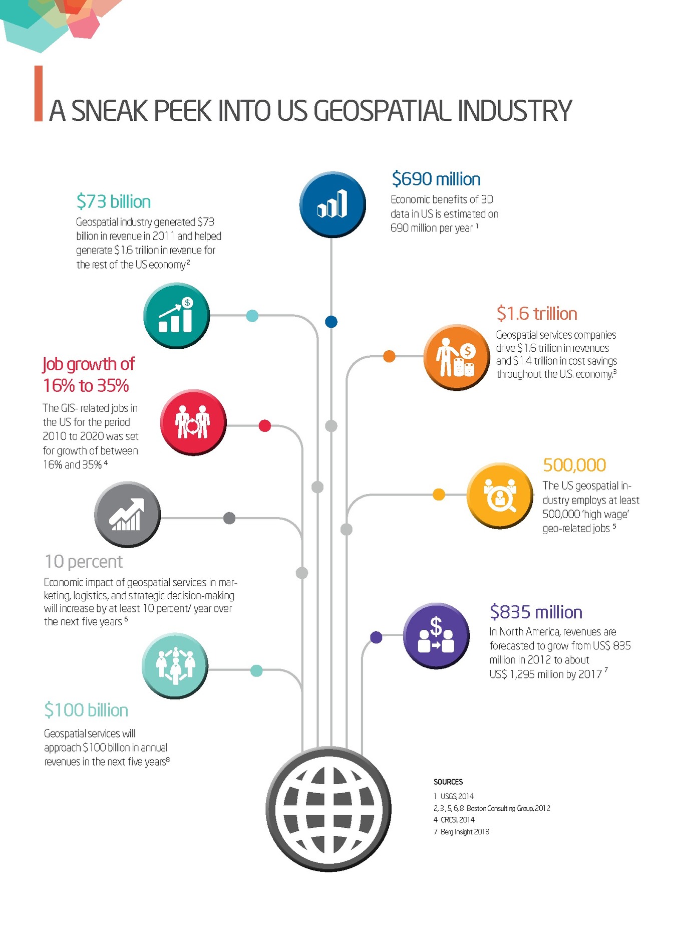
Geologic Subcommittee
The Geologic Subcommittee coordinates Federal and non-Federal interests in geologic data, including the facilitation of exchange of information and transfer of data; the establishment and implementation of standards for quality, content, and transferability; and the coordination of the identification of requirements and the collection of spatial data to minimize duplication of effort where practicable and economical.
In 2017, this Subcommittee focused its work on two standards that are essential to users and producers of geoscience maps, data, and reports: (1) the FGDC Digital Cartographic Standard for Geologic Map Symbolization, for which the Subcommittee provided maintenance, user support, and additional implementation formats; and (2) the “NCGMP09” data schema (ngmdb.usgs.gov/Info/standards/NCGMP09/), which is the emerging standard for geologic information in a GIS database. [This schema was named “NCGMP09” to indicate its origin, under the auspices of the National Cooperative Geologic Mapping Program (NCGMP).] Because geologic maps are produced by the USGS and each State Geological Survey, and by many other Federal, State, and other organizations, a standard data schema is critically needed in order to better enable data transfer and use, and to increase efficiencies in data management and migration from legacy to modern formats. The preliminary version of NCGMP09 was published in 2009, in the Proceedings of the Digital Mapping Techniques workshop (pubs.usgs.gov/of/2010/1335/pdf/usgs_of2010-1335_NCGMP09.pdf).
On behalf of this Subcommittee, the USGS, NPS, and Association of American State Geologists (AASG; representing the State geological surveys), the National Geologic Map Database (NGMDB) staff has coordinated the technical evaluation, revision, and publication of the NCGMP09 standard. Since 2009, the NGMDB has guided discussion and testing of NCGMP09 and has held lengthy technical sessions at each of the annual Digital Mapping Techniques workshops. Throughout the past 3 years, the AASG, NPS, and USGS held monthly or quarterly technical sessions in order to determine those aspects of the schema and documentation that warranted revision. The schema’s documentation and software tools have now passed USGS peer review and are being prepared for publication in the USGS Techniques and Methods series. When that has been completed, this essential standard will be brought before the Subcommittee for evaluation and public review as the Federal standard.
Homeland Infrastructure Foundation-Level Data Subcommittee
The Homeland Infrastructure Foundation-Level Data (HIFLD) Subcommittee develops, promotes, and executes a coordinated strategy for acquisition or development of homeland infrastructure geospatial information for Federal agencies while creating and utilizing partnerships with State, Tribal, territorial, local, and private organizations.
The subcommittee is supported by a HIFLD Program Management Group, which is composed of the following organizations: Department of Homeland Security (DHS) Geospatial Management Office, National Protection and Programs Directorate, FEMA, DOD’s Office of the Assistant Secretary of Defense for Homeland Defense and America’s Security Affairs; DOI Office of the Geospatial Information Officer; and the NGA.
The fiscal year 2017 accomplishments include the following:
- The subcommittee coordinated the instantiation of HIFLD Open, an online portal infrastructure enabling the dissemination of over 300 publically accessible Homeland Security Infrastructure Program (HSIP) data products and web services. Since its inception in February 2016, this HIFLD open site has been used by over 35,472 users with over 31,695 downloads of data.
- Subcommittee representatives participated in outreach events, such as the States Geospatial Intelligence Foundation conference and the National Alliance for Public Safety GIS Foundation Homeland Security Summit to address data needs and access challenges facing users from diverse stakeholder groups.
- The subcommittee briefed the HIFLD community regarding the HIFLD Open Data portal at the Esri Federal Users Conference and participated in a series of meetings with fusion center representatives at the Esri National Security Summit and Users Conference.
- The subcommittee regularly performed HSIP demonstrations for working groups and stakeholders at multiple levels of government, including the Tennessee Geospatial Information Council.
- As part of a new collaborative effort to foster ownership of geospatial data with authoritative sources, the HIFLD has partnered with the International Association of Fire Chiefs, to curate and improve HIFLD fire station data. It is the goal of the subcommittee to use this type of data partnering model to update other HIFLD data sets and improve its overall accuracy and quality.
- The HIFLD Subcommittee convened at a National Parcel Data Summit with 120 participants and discussed the critical importance of coordinating national leadership and resources towards the aggregation of a national parcel data layer. The Summit and subsequent followup Federal Parcel Requirements workshop were aimed at exploring ways to take a “whole-of-the-Nation” approach to satisfying a demonstrated need for national-level parcel data and its possible linkages to other ongoing FGDC initiatives (such as the National Address Database).
- HIFLD Subcommittee members have responded and assisted with homeland security events and natural disasters. HIFLD data was used to help provide foundation situational awareness for events like the 2016 Federal elections, the Presidential Inauguration, Super Bowl LI, the Indianapolis 500, the Boy Scout Jamboree, and Sail Boston. HIFLD data was also used in the Ardent Sentry National Level Exercise between the National Guard Bureau, FEMA, and other DOD/DHS components.
- In response to Hurricanes Harvey, Irma, and Maria, HIFLD members worked collaboratively to both provide a common centralized open site, using the Federal geospatial platform, to host and publish unclassified publicly available geospatial data. Both HIFLD4Harvey and HIFLD4Irma (which was also used to support Hurricane Maria) registered a total of over 12,850 users with over 2,920 downloads in a little over 30 days of being stood up. This first-of-its-kind type of operational response by HIFLD has been met with great enthusiasm and direct positive feedback from the Executive Office of the White House, to FEMA, to boots-on-the-ground first responders. The HIFLD Subcommittee stands ready and prepared to provide additional resources and support to FEMA as it continues recovery operations for all affected areas.
Marine and Coastal Spatial Data Subcommittee
The primary mission of the Marine and Coastal Spatial Data Subcommittee is to develop and promote the Marine and Coastal NSDI. The vision of the Marine and Coastal NSDI is that current and accurate geospatial coastal and ocean data will be readily available to contribute locally, nationally, and globally to economic growth, environmental quality and stability, and social progress.
For the past 5 years, the subcommittee has worked in an integrated manner, seeking critical partnerships with other Federal, State, and local governments, as well as with interagency and multisector activities in the marine and coastal environment focusing on spatial data. These activities include the National Ocean Council and the ocean.data.gov data portal, the Integrated Working Group on Ocean and Coastal Mapping (W–O&C) in their development of a national coastal mapping strategy, and the Integrated Ocean Observing System, to name a few key initiatives. The subcommittee accomplishments for 2017 include the following:
- Led activities to complete all requirements of the NGDA Management Plan for the Water – Oceans and Coasts Theme including the development of a W–O&C Theme Implementation Plan and ensuring all NGDAs have mapping services and that they are registered with the GeoPlatform.
- Expanded the use of the Coastal and Marine Ecological Classification Standard (CMECS) for coastal mapping across the United States. The CMECS provides a national framework for organizing information about coasts and oceans and their living systems. It provides a structure for developing and synthesizing data so that ecosystems can be identified, characterized, and mapped in a standard way across regional and national boundaries. The CMECS also supports status and trend-monitoring activities, policy development, restoration planning, and fisheries management.
- Worked to expand the subcommittee’s outreach to the coastal and marine geospatial community. Members of the subcommittee, as part of the UN–GGIM, received approval for the creation of the new Marine Information Working Group.
National Digital Orthoimagery Program Subcommittee
The National Digital Orthoimagery Program (NDOP) is an activity of the U.S. Government responsible for managing and coordinating overhead imagery and applications to support the operational needs of civil government in the United States.
The NDOP serves as a subcommittee of the FGDC. As a member organization of the FGDC, the NDOP formulates the U.S. national strategy and implementation plan for collection and use of orthoimagery products and data to meet U.S. civil obligations and purposes.
In 2017, the NDOP accomplished the following:
- Continued to develop a common framework for requirements development, collection, and applications development related to the mission of NDOP and its member agencies. The USDA Farm Service Agency (FSA) acquired a little over 1.7 million square miles of four band (natural color and near color infrared) imagery in 26 States. Three States were collected at .6-meter resolution through a partnership “buy-up” option and all the remaining States are at 1-meter resolution. The current National Agriculture Imagery Program (NAIP) indefinite delivery indefinite quantity contract that was scheduled to end in 2016 was extended for an extra year to allow for additional time in completing imagery requirements analysis for 2018 and beyond. The anticipated FY18 budget reductions is expected to reduce future NAIP coverage to approximately one million square miles annually—roughly 59% of the 2017 coverage. An integrated project team is being established to investigate alternative solutions to address the uncertainty of the out-year budgets.
- The USGS Land Remote Sensing Program tendered an NDOP request for a summer-seasonal collection of the State of Alaska via the Civilian Applications Committee, which the LRS Program oversees. This request was targeted to fulfill outstanding needs for more accurate digital modeling of the surface area of Alaska. The LRS Program will use the resulting dataset to provide for a broad variety of public needs for high-resolution orthoimagery data in the Alaskan region. Public agencies operating in Alaska have missions related to protecting public lands, mapping inland and coastal waterways, and performing natural resource management, wildfire response, and other public mandates. This request is being coordinated with the National System for Geospatial-Intelligence of which the USGS is a member organization.
- NDOP has been coordinating the high-resolution scanning of historic aerial photography with an emphasis on the National High Altitude Program (NHAP). The NHAP was one of the first interagency geospatial programs in the Federal Government that coordinated acquisition to eliminate duplicate efforts by various government programs. At the end of FY 2017, over 55% of the digital Color Infrared collection was made available via USGS Earth Explorer site.

Imagery acquired by USDA/Farm Service Agency in 2017 through the National Agriculture Imagery Program (NAIP).

Years of NAIP coverage by State during 2002–2017
- NOAA collected 41 tide-controlled coastal imagery datasets to support shoreline mapping efforts and also collected oblique imagery along the Gulf coast and South Atlantic coast for coastal zone management applications. In addition, NOAA acquired emergency response imagery to support relief efforts after Hurricane Matthew and a flooding event in Louisiana.
- After 44 years in operation, the USGS Optical Science Laboratory (OSL) closed its doors in the J.W. Powell Federal Building at the USGS National Center in Reston, Virginia, on March 16. The OSL’s calibration efforts led to major improvements in the systematic collection of aerial imagery of the conterminous United States and was integral to the success of programs such as the NHAP Program, National Aerial Photography Program, and the NAIP. In support of NDOP and other Federal needs, the OSL calibrated 3,705 aerial film cameras during its many years of operation and supported more than 200 aerial imaging companies to meet the performance and accuracy standards required by U.S. Federal agencies, as well as many State and local governments, for diverse mapping projects.
- The USGS National Geospatial Program (NGP) will retired the High Resolution Orthoimagery (HRO) portion of imagery and services on October 1, 2017. HRO data generally consist of 1-meter or better resolution, leaf-off, orthorectified imagery products acquired over the Nation’s major urban regions, and are provided through The National Map. The NGP is continuing support of access to National Agriculture Imagery Program orthoimagery data and services, provided by the U.S. Department of Agriculture. Access to the source imagery used in the generation of the standard HRO data products and services will continue to be made available through EarthExplorer by the USGS Land Remote Sensing Program.
- The NDOP members (USDA—Natural Resources Conservation Service, USDA—FSA, NOAA, and DOD—NGA) have worked together to acquire new Orthoimagery in FY 2017 for the following areas in Hawaii and the U.S. Pacific Basin: Hawaii, Palau, Federated States of Micronesia, and American Samoa.
- The NDOP Technical Management Subgroup holds teleconferences every month or two during the year. These meetings are designed for sharing news and information, working on projects, and providing training or updates of items of interest and importance to the various individuals and agencies. An item of particular interest and effort for 2017 has been options for geo/orthorectification of scanned aerial film and unmanned aircraft systems (UAS) imagery (drones). Demonstrations and examples of software, processes, products, and experiences have been provided in the teleconferences by a number of companies and organizations. Other discussion items have included the following: privacy issues involving UAS data, scanning projects by other organizations, licensing of satellite imagery, Lidar & Phodar, 2022 National Spatial Reference System, CIBORG, impacts of the closure of the USGS OSL, and new satellite sensors and data.
Spatial Water Data Subcommittee
The Advisory Committee on Water Information (ACWI) and the FGDC created the Subcommittee on Spatial Water Data (SSWD) to assist coordination of Federal and non-Federal interests in spatial water data, including (1) facilitating the exchange of information and transfer of data; (2) establishing and implementing standards for quality, content, and transferability; and (3) coordinating the identification of requirements and the collection of spatial data to minimize the duplication of effort where practicable and economical.
The SSWD has been leading efforts to engage the community and to design and scope the Open Water Data Initiative (OWDI). The OWDI was launched by the FGDC and the ACWI in the summer of 2014. The goal of the OWDI is to bring currently fragmented water information into a connected, national water data framework by leveraging existing systems, infrastructure, and tools to underpin innovation, modeling, data sharing, and solution development. Since 2014, progress has been made through the OWDI by applying a common geospatial framework of rivers, watersheds, and other geographic features to water observations made by various Federal, State, and local agencies. This approach is beginning to take form as an infrastructure that leverages existing systems using a modern cloud-based big-data approach, to provide interoperable web data and map services. An API for water information (api.nasa.gov/, for an analogous example) is being unleashed for innovators and solution developers.
NHDPlus High Resolution
The foundation for the common geospatial framework underlying OWDI will be the NHDPlus High Resolution (NHDPlus HR), which the USGS began releasing in beta version in May 2017. At the end of FY17, the NHDPlus Beta is available for more than a third of the area of the conterminous United States. The NHDPlus HR Beta production and release will continue on a regional basis through 2018 for the conterminous United States, followed by Alaska, Hawaii, and the U.S. territories in later years. Users are invited to review the beta version datasets, and their feedback will be used to update and improve subsequent NHDPlus HR dataset releases.
When completed for the entire Nation, the NHDPlus HR will provide a single, scalable hydrography framework that is open and accessible for use by everyone, including government, citizens, and industry. The NHDPlus HR will support a limitless range of applications, such as estimating when and where a toxic spill will affect downstream populations, ecosystems, and drinking water intakes, or helping property owners to better understand water availability.
The NHDPlus HR framework is key to bringing flood forecasting down to the street level in the national water model. In the StreamStats Program, NHDPlus HR can help to provide more accurate streamflow statistics, such as peak flows for bridge or culvert engineering designs and low flows for studies of biological resources in times of drought. Similarly, it can be used by the National Water-Quality Assessment to better understand the Nation’s water quality.

Map showing availability of NHDPlus high-resolution datasets.
National Water Model
NOAA’s National Water Model (NWM) has continued development in FY17. The NWM is based on the geospatial hydrographic data framework of a reformulated national seamless geodatabase of NHDPlus version 2, developed by SSWD WGs and based on community feedback during 2015. Using this data framework, the NWM increases the spatial detail of modeling from about 3,600 forecast points to about 2.7 million stream segments. Results of the NWM are now available in the form of web services, giving continuously updated current and forecasted streamflow estimates for each of the 2.7 million stream segments nationwide. The greatly improved spatial detail of forecasts will provide better information to emergency responders, enabling them to improve their response and save lives. Discussions are underway between the USGS and NOAA on scaling of the geospatial hydrographic framework, to provide additional detail to the NWM for specific areas. Further improvements to the NWM anticipate use of very high-resolution lidar data to improve flood inundation mapping.
Reclamation Water Information System
In April 2017, the Bureau of Reclamation (Reclamation) announced the launch of its new data portal, the Reclamation Water Information System (RWIS). This new pilot system consolidates and publishes Reclamation’s water and related data, making it easy to locate, access, and use. The site currently offers daily data for past and present streamflows, reservoir operations, canal flows, and other parameters for sites across all of Reclamation’s five regions. A web service lets you automate data queries for easy integration into applications and models. See water.usbr.gov/ for more details.
Network Linked Data Index
The hydro Network Linked Data Index (NLDI), which began in FY16, has seen continued development in FY17. Additional data sources, including a sensor network for New Jersey, the National Pollutant Discharge Elimination System, and additional capabilities, include basin delineation and basin characteristics.The system effectively is a search engine for water-quality data, much like the Google search engine, but is even more powerful because the system understands the underlying structure of the stream network, which is provided by the NHDPlus. The system currently is based upon the NHDPlus version 2 (1:100,000-scale) network. The source code for this system (NLDI) is being shared in an open-source GitHub repository that has been established for the SSWD. See github.com/ACWI-SSWD.
The NLDI can be extended and generalized so that other types of data (beyond water-quality data) can be added, and it can easily be modified to use the much more detailed geospatial framework of the NHDPlus HR as it becomes available. See owi.usgs.gov/blog/nldi-intro/ for additional information on the NLDI.
Other highlights from FY 2017 include the following:
- Spill response: A workgroup report was presented on best data management practices related to the International Conference on Environmental Data Management (ICEDM). The ICEDM is a forum for networking and collaborating among industry leaders in the environmental data management industry. This collaborative atmosphere has resulted in the formation of the ICEDM Best Management Practices Group (ICEDM BMP Group). The group’s mission is to provide vendor and platform-neutral guidance documents defining the best management practices for the environmental data management industry.
- Aquatic ecology: Several participants indicated interest in forming a working group to focus on datasets relevant to aquatic ecology, such as depth, frequency and timing of flows, habitat, sedimentation, and many other issues.
- Inland bathymetry: Discussions on establishing a working group to look into inland bathymetric data generated high interest and may be pursued in the future.
Transportation Subcommittee
The Transportation Subcommittee’s mission is to support and enhance the Transportation Theme of the NSDI.
The subcommittee has been facilitating partnerships and coordinating efforts through bimonthly webinars during which different agencies present their work. This year the subcommittee hosted speakers from the Federal Highway Administration, the Census Bureau, the BTS, the Volpe Research Center, the USACE, and NOAA. Their topics included the All Roads Network of Linear Referenced Data (ARNOLD), Master Address File/Topologically Integrated Geographic Encoding and Reference (MAF/TIGER) database updates, how GATRES is used to update Census road networks, the On The Map application, the National Transit Map, the Intermodal Passenger Connectivity Database, Transportation Deserts, the Inland Automatic Identification System, and Electronic Nautical Charts.
The subcommittee has also been working diligently to author the MCG of the United States Road Network (USRN). The USRN is a derivative of ARNOLD and will contain the essential attributes that make the road dataset meaningful to the transportation community. The MCG will specify the content of the USRN. The subcommittee is also working to update its charter. Having collected, reviewed, and integrated comments, the subcommittee will forward the updated charter to the Coordination Group.
Vegetation Subcommittee
The FGDC Vegetation Subcommittee is responsible for promoting current and accurate standards for vegetative data, exchanging information on technological improvements for collecting vegetative data, and encouraging the Federal and non-Federal community to identify and adopt standards and specifications for vegetative data. The resulting U.S. National Vegetation Classification (NVC) has been used in vegetation classification, mapping, and inventory efforts across the Nation. Numerous partnerships have developed between Federal agencies, States, Tribes, localities, academia, and the private sector, and the subcommittee has been supporting these natural resource needs of users.
In 2017, members of the Subcommittee worked to transfer NVC information to potential users. A paper on the International Association for Vegetation Scientists (IAVS) working group was published in the scientific journal “Phytocoenologia.”1 Thirteen posters regarding the NVC were presented at the annual meeting of the Ecological Society of America (ESA) in Portland, Oregon, in a special session2 that provided examples of the direct application of the classification, demonstrated tools that have been developed to increase access to the standard, and highlighted the network of ecologists who are helping to develop the classification. It was a resource for Federal agencies and programs that use this Federal standard and classification in their planning and management activities. In addition, another paper was presented to the NVC at that meeting and one was presented at the IAVS meeting in Italy.
The Subcommittee hosted a full-day field trip for the attendees of the ESA Annual Meeting to the South Prairie Botanical Area on the Gifford Pinchot National Forest in southwestern Washington. The trip, which was sold out, highlighted the use of the NVC in definition and monitoring ecological change in significant natural areas.
In 2017, there was a focus on helping land managers translate their existing classification systems into the NVC. Several meetings were held on strategies for crosswalking existing classifications to the NVC, where partners presented the challenges they faced. The Forest Service’s Implementation Management Team continued to meet and work with members of the Vegetation Subcommittee to assist Forest Service Regional Ecologists in translating their classifications to the NVC. Also, several training webinars were given by Subcommittee members to guide the Forest Service Regional Ecologists in the use of keys, autokeys, and crosswalks in classification translation.
Although the initial content hierarchy had been completed, the Subcommittee anticipated a need for making changes to the content as time went on. A process was formalized that required proposed changes to be first submitted as proposals that would be subjected to scientific peer reviews. Proposals judged to have scientific merit would initiate changes in the classification and the documentation would be published online in the proceedings of the NVC. This process became formal in 2017 and the first article of the USNVC Proceedings was made available through the ESA website (50.87.248.75/~usnvcorg/proceedings/index.php). That article was both a comprehensive scientific peer review of USNVC content and a test of the formal peer-review process for the dynamic standard.
For several years, software and server upgrades and maintenance of the server and NVC components had been deferred, so the stability of the NVC server became a concern by 2017. A year-long analysis of needs for sustainability and the accompanying budget was conducted with the help of a contractor. Agencies were petitioned for the funding but to date the Subcommittee was not able to secure the funding. Meanwhile, two of the major agency partners, the USFS and the USGS, continued to fund the education and content management responsibilities for the NVC.
1Franklin, S.B., Hunter, J., De Cáceres, M., Dengler, J., Krestov, P., and Landucci, F., 2016, Introducing the IAVS Vegetation Classification Working Group: Phytocoenologia, v. 46, p. 5–8. DOI: 10.1127/phyto/2016/0116.
2McKerrow, A.J. (moderator), 2017, “U.S. National Vegetation Classification: Advancing the Description and Management of the Nation’s Ecosystems,” organized poster session, August 6–11, 2017: Ecological Society of America, Portland, Oregon.

Field trip participants carefully step into a fen at the South Prairie Botanical area of the Gifford Pinchot National
Forest in Southwestern Washington. The August 6th field trip was a part of the Ecological Society of America’s
2017 meeting in Portland, Oregon, and was hosted by the FGDC Vegetation Subcommittee.
Wetlands Subcommittee
The Wetlands Subcommittee promotes standards of accuracy and consistency in Federal geospatial wetlands data, exchanges information on technological improvements for collecting spatial wetlands data, encourages Federal and non-Federal communities to identify and adopt standards and specifications for spatial wetlands data, and collects and processes the requirements of Federal and non-Federal organizations for spatial wetlands data. This year, the Subcommittee worked on the following:
- Wetlands data for over 30 million acres of the United States were contributed to the NSDI wetlands layer from nine Federal, State, and local agencies in fiscal year 2017. All data submitted to the NSDI wetlands layer must comply with the National Wetlands Classification Standard and the FGDC Wetlands Mapping Standard. Rigorous quality-control and quality-assurance processes and tools are implemented at all points within the data creation and submission process.
- Future updates to the NSDI wetlands layer will be guided by the Wetland Mapping Targeting Tool (WMTT), which was developed in Federal fiscal year 2017 to guide the investment of resources to meet the needs of multiple dataset users. To actualize the WMTT, a national algorithm was developed to identify portions of the NSDI wetland layer that are no longer contemporary, in addition to areas where the dataset could benefit from the use of improved inputs and advanced production protocols. The WMTT is easy to use, spatially explicit, and can be tailored to meet multiple application needs.
- The Interagency Wetland Mapping Workgroup, which was created in 2016 to better coordinate national wetland mapping efforts at all spatial and temporal scales, met multiple times throughout the year to identify initial objectives and high-priority actions. Initial workgroup activities included hosting of a scientific session entitled “Mapping and Monitoring Wetlands Across the U.S. to Support Strategic Management of Natural Resources” at the 2017 Society of Wetland Scientists annual meeting in San Juan, Puerto Rico. At the meeting, representatives from the FWS, USGS, NOAA, EPA, as well as the Association of State Wetland Managers, presented information on national scale wetland mapping and monitoring datasets and how they are being used to support conservation and management of natural resources.
- The FWS produces wetlands status and trends reports on a decadal basis to supplement information contained within the NSDI wetlands layer. While the NSDI wetlands layer provides site-specific details necessary to guide a multitude of natural resources management decisions, primarily at the local scale, the Status and Trends reports provide temporally consistent information on acreage, as well as information on wetland and deepwater habitat acreage changes through time to support the development of broader scale policies. The Status and Trends updating cycle was initiated in Federal fiscal year 2017. Resultant data will be used to supplement, as well as further, target updates of the NSDI wetlands layer.
Architecture and Technology Working Group
The Architecture and Technology Working Group (ATWG) is charged with providing technical development direction and guidance to support the managing partner with respect to the Geospatial Platform operations. The ATWG is working to establish the framework for requirements management, including technology and tool development and implementation, to enhance and extend the Geospatial Platform (Geoplatform.gov) capabilities.
Notable fiscal year 2017 accomplishments of the ATWG include the following:
- ATWG conducted working group meetings to discuss topics associated with the continued development of the Geospatial Platform including system/technology issues impacting member agencies, beta-testing results for Geoplatform.gov Release 8, functionality updates for Releases 9 and 10, and agency/department-specific architecture or technology issues, concerns, and successes.
- Provided formal recommendation to the Geospatial Platform Managing Partner to publish the approved “white list” of the software that comprises the approved infrastructure behind the GeoPlatform functionalities and the software (and versions) under testing for future updates.
- Provided formal recommendation to Geospatial Platform Managing Partner to continue dialog efforts with the larger geospatial community on the concept of implementing (and timing of) enhanced search/discovery of GeoPlatform content and services, which requires some development, improved metadata, and more modern metadata tools and standards.
- Provided formal recommendation to the Geospatial Platform Managing Partner to consider leveraging existing open-source volunteered-geographic information toolsets for the GeoPlatform community to enable and extend Department and Agency community geospatial outreach efforts in a coordinated approach though the GeoPlatform infrastructure.
- Provided formal recommendation to the Geospatial Platform Managing Partner to consider implementing a restricted access environment capability (or leveraging existing capabilities) within the GeoPlatform with identity management controls to facilitate cross-Agency web map sharing
Metadata Working Group
The Metadata Working Group (MWG) promotes awareness and best practices among FGDC member agencies and NSDI stakeholders about the metadata component of geospatial data; facilitates the coordination, development, use, sharing, and dissemination of geospatial metadata; supports the implementation of geospatial metadata and other related semantic and structural (that is, nongeospatial) metadata standards established by Federal, national, and international standards organizations, such as the FGDC, OGC, American National Standards Institute, ISO, Dublin Core Metadata Initiative, Open Source Metadata Framework, Ecological Metadata Language, and the World Wide Web Consortium.
In fiscal year 2017, the MWG provided direct support to the FGDC Metadata Program and actively engaged in a range of NSDI initiatives, including the following:
- Proposed endorsement of the metadata standard ISO/TS 19115-3:2016 Geographic information—Metadata—Part 3: XML schema implementation for fundamental concepts (September 2017).
- Participation and presentations within the ISO Metadata Summit and Tools sessions, MWG quarterly teleconferences, FGDC Standards Working Group, ISO Implementation Forum, and the Esri Metadata Special Interest Group meeting (July 2017).
- Participation in metadata activities supporting the NGDA Portfolio management, Project Open Data, Data.gov, and GeoPlatform.gov, including review of the GeoPlatform Profile and Object Editor.
- Assessment of the NSDI Strategic Framework and the role of metadata to support specific tasks.
- Served as the primary conduit for the communication about geospatial metadata and other related semantic and structural (nongeospatial) metadata standards, tools, training, and implementation.
- Coordinated with the INCITS–L1 group who provided regular ISO geospatial metadata updates for the MWG.
National Boundaries Group Working Group
The National Boundaries Group (NBG) is an interagency working group that contributes to the FGDC mission to foster collaboration and develop partnerships for the advancement of the NSDI. The purpose of this group is to lead the development of nationally consistent boundaries that are integrated using the same geographic base, allowing for Federal boundary sources to be consistent, accurate, and integrated through interagency collaboration.
National Boundaries Group Organization and Operations
The NBG continued collaboration with the Cadastral Subcommittee to identify boundaries coincident with cadastral features such as parcels and the PLSS. The Census Bureau used the results of this activity for the Boundary Quality Assessment and Reconciliation Project. In addition, the NBG moderated a discussion about public access to data for military land boundaries from the DOD and the USACE.
Federal Lands Working Group
The Federal Lands Working Group (FLWG), a subgroup of the NBG, developed data standards and organizational strategies for federally owned lands with the publication of an aggregated Federal lands geodatabase to meet common agency needs. In FY 2017, the FLWG developed an online tool for Federal Agencies to identify and review boundary gaps and overlaps. This tool provides a platform for the interactive review and integration of federally managed land within the framework of the PAD–US.
The FLWG introduced PAD–US in presentations to the DOI’s Office of Policy Analysis seminar series and to the FGDC Coordination Group. Additional briefings for Senate GIS staffers, the Congressional Research Service, and the Library of Congress were held in early 2017. The map of the PAD–US was featured in the plenary session and map gallery of the Esri FedGIS Conference.
Tribal Boundaries Subgroup
The Tribal Boundaries Workgroup is cochaired by members from the Census Bureau and the EPA, with membership consisting of Federal agencies, private industry, Tribal organizations, and federally recognized tribes. In 2017, the group hosted presentations from the BIA, FLWG, BLM, and more.
International Boundaries
The IBC and the International Boundary and Water Commission (IBWC) updated the NBG on their work to improve the international boundaries with Canada and Mexico. The NBG continued its collaboration with the Census Bureau, IBC, and IBWC to update the international boundaries in the MAF/TIGER Database.
Standards Working Group
The FGDC SWG promotes development and implementation of standards for the NSDI and advances key Federal Responsibilities in the NSDI Strategic Framework. Its charter was updated to advance NSDI initiatives, such as the Geospatial Platform and National Geospatial Data Asset (NGDA) portfolio management. In FY 2017, the SWG advanced INCITS/ISO 19115-1:2014 Geographic information—Metadata—Part 1: Fundamentals and INCITS/ISO 19157:2013[2014] Geographic information—Data quality standard to FGDC endorsement. See standards section for detailed information on these standards.
In addition, the SWG advanced the United States Thoroughfare, Landmark, and Postal Address Data Standard and ISO/TS 19115-3:2016, Geographic information—Metadata—Part 3: XML schema implementation for fundamental concepts through the FGDC standards review and approval process.
The SWG members continued their leadership and participation in INCITS Technical Committee L1, Geographic Information Systems; ISO Technical Committee 211, Geographic information/Geomatics; the Geospatial Intelligence Standards Working Group; and the OGC.
Main Report