![]()
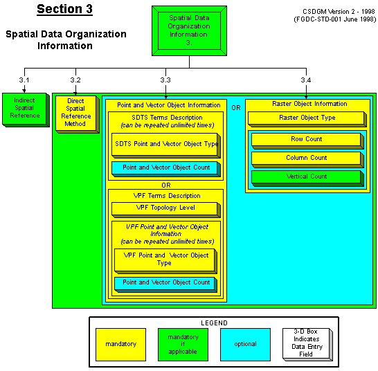
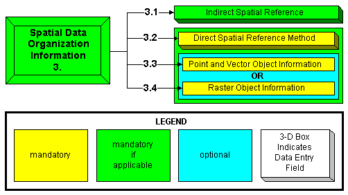
3. Spatial Data Organization Information (Mandatory if Applicable)
CONTAINS
3.1 Indirect Spatial Reference (Mandatory if Applicable)
AND
(3.2-3.4 Direct Spatial Reference) (Mandatory if Applicable)
![]()
(3.2-3.4 Direct Spatial Reference) (Mandatory if Applicable)
CONTAINS
3.2 Direct Spatial Reference Method (Mandatory)
AND
(3.3-3.4 Spatial Object Information) (Optional)
![]()
(3.3-3.4 Spatial Object Information) (Optional)
CONTAINS
A CHOICE BETWEEN 1 OF 2 ELEMENTS
{ 3.3 Point and Vector Object Information (Mandatory)
OR
3.4 Raster Object Information (Mandatory) }
Above Image (GIF) (9495 bytes)
Large GIF image (12,931 bytes)
Return to:
An Image Map of the FGDC's Content Standard for Digital Geospatial Metadata