![]()
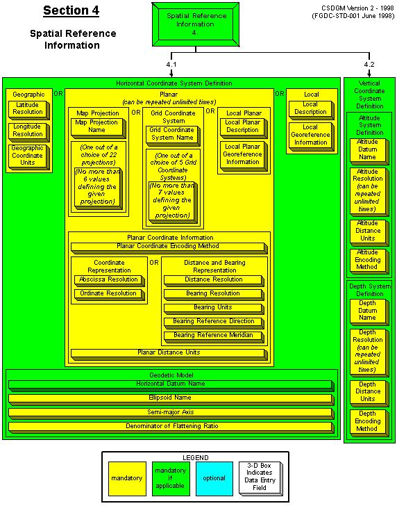
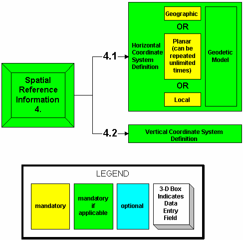
4. Spatial Reference Information (Mandatory if Applicable)
CONTAINS
4.1 Horizontal Coordinate System Definition (Mandatory if Applicable)
AND
4.2 Vertical Coordinate System Definition (Mandatory if Applicable)
![]()
4.1 Horizontal Coordinate System Definition (Mandatory if Applicable)
CONTAINS
A CHOICE OF 1 OUT OF 3 ELEMENTS:
{ 4.1.1 Geographic (Mandatory)
OR
4.1.2 Planar (Mandatory) (can be repeated unlimited times)
OR
4.1.3 Local (Mandatory) }
AND
4.1.4 Geodetic Model (Mandatory if Applicable)
Large GIF image (21,391 bytes)
Return to:An Image Map of the FGDC's Content Standard for Digital Geospatial Metadata